Hawn State Park, just east of Farmington, MO, hosts one of the largest trail networks in the Missouri state park system. This post describes a hike along the Pickle Creek Trail, which follows a deep ravine exposing some very interesting outcrops of granite. These outcrops are right along the edge of the outcrop zone of igneous rocks in the St. Francois Mountains. From the outcrops along Pickle Creek to the park entrance, these rocks descend a couple dozen meters of Cambrian and Ordovician sedimentary rocks. Only a few km further east, and you hit the western edge of the Reelfoot Rift system, meaning you have to drill through nearly 4 km (13,000 feet) of sand, mud, and lime to study these rocks.
The 3.2 km (2 mi) Pickle Creek Trail follows what geomorphologists describe as an Ozark stream, a sand or gravel-choked streambed fed by numerous springs and seeps from the surrounding bedrock. The creek has cut down through the Lamotte Sandstone, a late Cambrian sedimentary rock. The Lamotte is the first event represented in the geologic record following the formation of the St. Francois igneous rocks some 700 million years earlier. It marks the first encroachment of the sea on the region for a long, long time. Unfortunately, the contact between the Lamotte and the underlying igneous rocks is not well exposed along the trail. It's always nice to find these contacts and place your finger on a tiny interval that marks the passage of deep time.
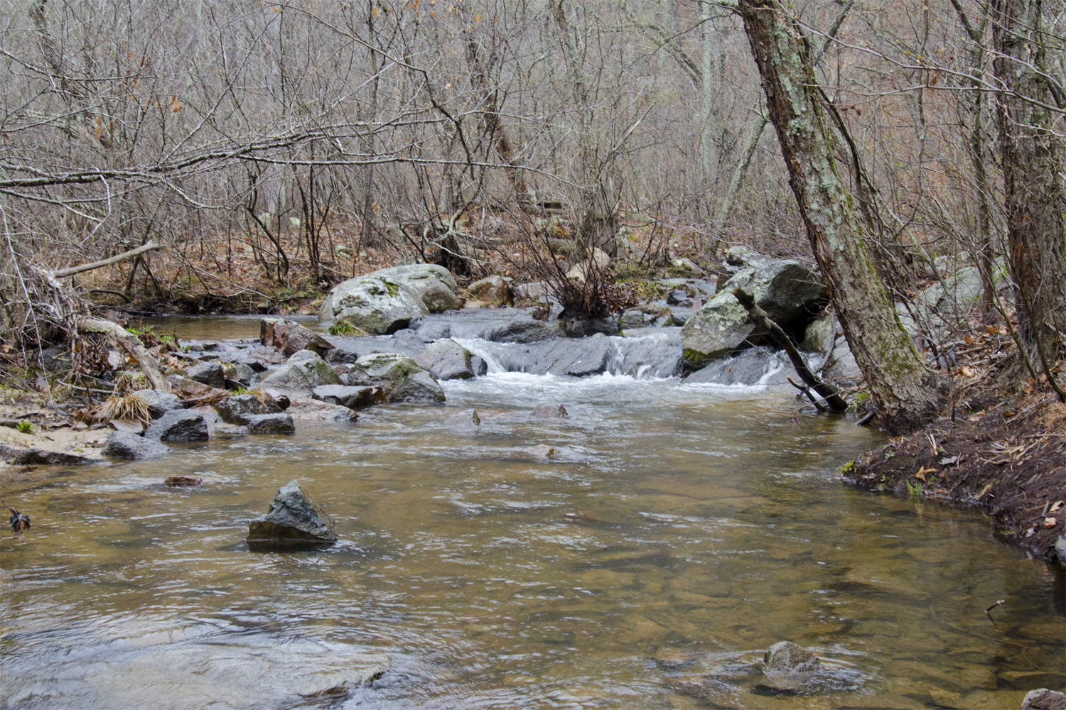
One of the many small cascades along Pickle Creek.
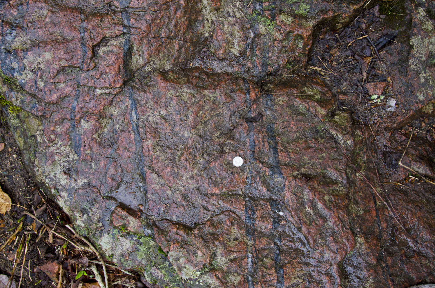
The igneous rocks exposed along Pickle Creek are granites and granodiorites, coarse-grained rocks that had time to grow large crystals before they cooled off. These rocks are intrusive, and need something to well, intrude into. As mentioned in the introduction post to the region, the geologic context for the formation of the St. Francois igneous rocks is not very well understood. In many situations, studying the kinds of rock that the igneous rocks intruded into can provide a few clues. Unfortunately, there aren't many of those rocks left around. Most of the rocks overlying the St. Francois Terrane - at least a kilometer of material - was obliterated by that 700 million year period of erosion. And within the St. Francois Terrane itself, the previously existing rocks appear to have been entirely replaced by newly forming rocks. But in one small exposure along Pickle Creek, we do get a glimpse of the rocks that used to be there.
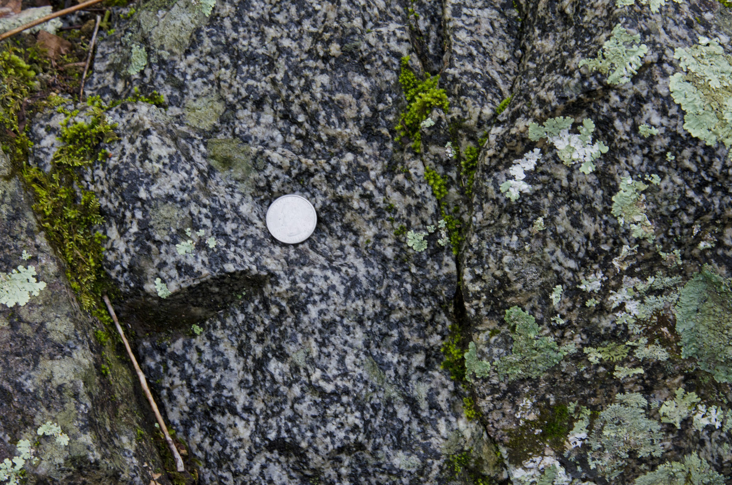
The speckled rock seen here is a granodiorite, a rock geologists like to refer to as salt-and-pepper rock. It's not hard to see why. This rock is moderately rich in silica, and contains white plagioclase (sodium-calcium feldspar), milky quartz, and dark crystals of hornblende. The distinctive pink color of most St. Francois igneous rocks isn't present here - the potassium-rich alkali feldspar and oxidized iron that gives them their color is absent. The granodiorites in Hawn State Park are described as a gneiss, a type of metamorphic rock that is dominated by quartz and feldspar. During metamorphism, the rock has a directional pressure applied to it, which causes blady crystals to realign perpendicular to the direction that the pressure is being applied. This realignment creates a foliation, or a clear directional orientation (and often compositional layering) of crystals. This is not the most spectacular gneiss you will ever see, since the foliation isn’t highly well developed, but you can see that the dark crystals generally align from upper left to lower right.
To get a gneiss, you need both a highly-directional pressure to force the mineral grains into alignment, as well as a heat source that softens the rock and allows the crystals to relax enough to smoosh. It's unlikely that the St. Francois igneous rocks are responsible for the development of the foliation - they rocks formed relatively close to the surface, meaning they couldn't provide pressure component to align the crystals. That means the gneiss formed before the rocks of the St. Francois Terrane, and likely originated deeper in the crust. Unfortunately, the gneisses appear to have been stripped of their formation context by the St. Francois Terrane, meaning they're not much help in interpreting its origin. Radioisotope dating doesn't add too much, either.Geochronologists dating zircons with the U-Pb system in the granodiorite come up with an age of 1500 +/- 30 Ma - suspiciously close to the age of the St. Francois Terrane (1470 Ma). It’s likely that the St. Francois Terrane rocks heated the granodiorite gneiss enough to let lead escape from the zircon's crystal structure, mostly or totally resetting the crystal's radioisotope clock.
A field guide written for the 1976 Association of Missouri Geologists field trip (available for download here) indicates that shortly after leaving the picnic area at the trailhead, we should come across a pegmatite dike. The location of this dike is marked by a small pit where artisanal miners dug for feldspar during the 1920s. Judging from the description, the pit was already been mostly reclaimed by nature when the guide was written, and the 40 years since have not been kind. Pegmatites usually contain the extremely watery last remnants of a melt, and commonly carry all sorts of geologic goodies with them. By this point in a magma's crystallization, many of the elements that have a difficult time fitting into crystal structures have nowhere else to go. This causes the formation of unusual minerals that are rich in valuable elements like lithium, beryllium, tin and tungsten. In addition, the high proportion of water suppresses the solidification temperature, allowing minerals to grow to abnormally large sizes. The feldspar crystals in this pit were apparently pretty large - great source material for porcelain and other ceramics. In addition, this pit contained greenish-brown books of biotite that were up to 12.5 cm (5 in) thick. Unfortunately a search of the area didn't turn up any broken rock from the pit, so I don't have any pictures of this material.
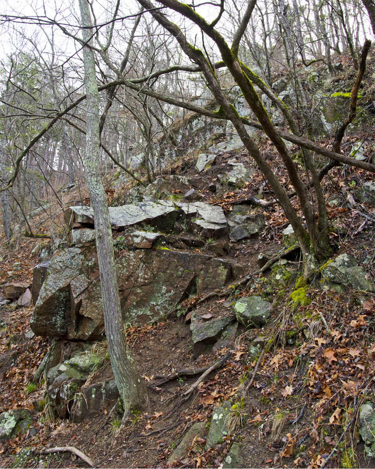
However, the next dike that we come across, about 200 m (700 feet) from the trailhead, is clearly visible from the trail:
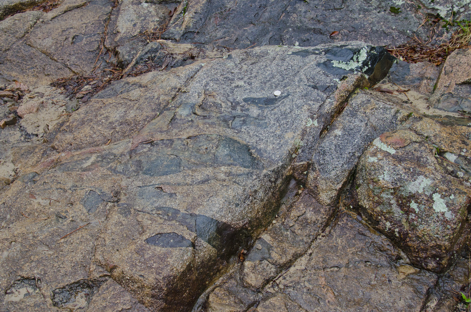
A dike of granitic rock bisects the valley here. The erosionally resistant rocks of this dike form a small wall that nearly pushes the trail into the creek! Looking closely, we can see that most of this dike has a very fine texture, but contains large crystals of a reddish alkali feldspar called microcline. Geologists call this mixture of coarse crystals in a fine-grained groundmass a porphyritic texture. Porphyritic granites are pretty common and mostly unremarkable on the geology side (although they do make great counter stone, always a good way to get your geologist friends talking!). But if we look more closely, the feldspars here a little strange. These crystals have a small rind around them, as if the crystal has grown a shell around itself.
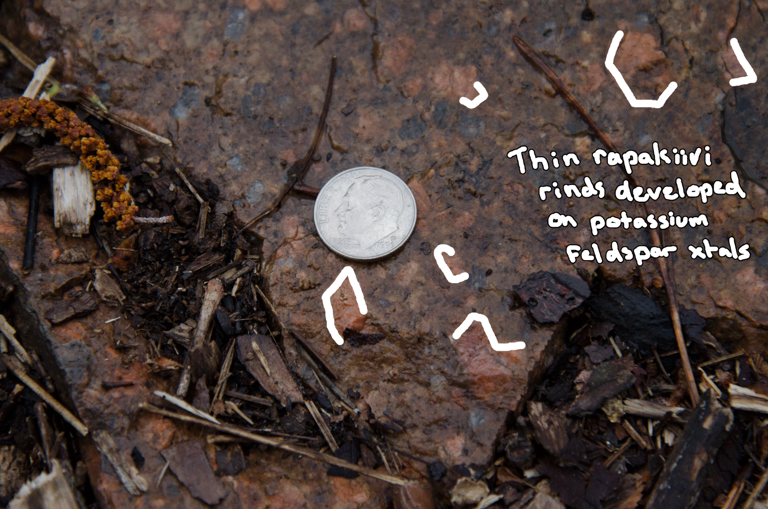
This rind is plagioclase - a more calcium-rich flavor of feldspar. The rind's presence indicates a rapid change in the magma chemistry. As magmas crystalize, the solid and liquid phases stay in compositional equilibrium with one another. If that equilibrium is disrupted, the crystals and magma start exchanging elements with one another until equilibrium is restored. If this happens, the magma might crystalize new phases, or the crystals start dissolving. This particular arrangment of plagioclase rind on a microcline core is called a rapakivi texture. Rapakivi is Finnish for "crumbly rock", and the slightly different thermal properties of plagioclase tend to make it crack, weakening the host rock. This texture first noted in the Karelia region of SE Finland/W Russia. The commonly cited mechanism for the formation of a rapakivi texture is through a large eruption. This disrupts the equilibrium of a melt both by reducing the magma's pressure and temperature. These conditions generally favor the dissolution of microcline (explaining the crystal's slightly rounded shape), but if the magma cools quickly enough a thin rind of plagioclase forms instead. The presence of rapakivi here suggests that it formed shortly after a caldera eruption. The large number of faults created by a caldera collapse also provide a conduit for small dikes – perfect conditions for preserving rapakivi texture.
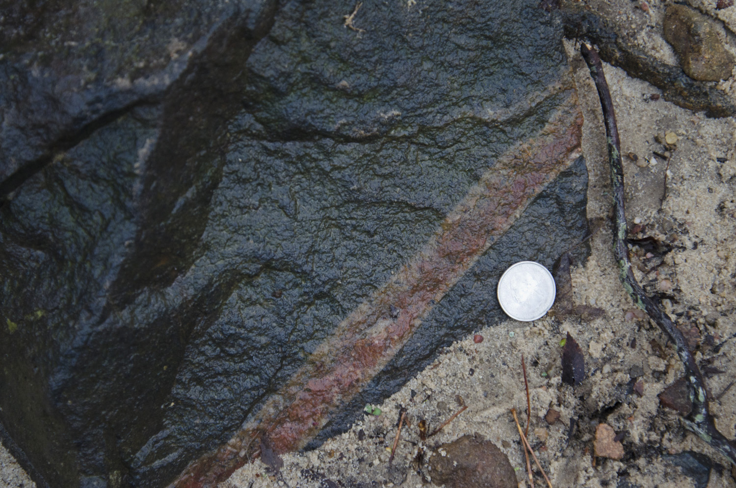
Another neat feature of this granite dike is some secondary veins that cut through it. These appear to have formed well after the dike cooled, because they have sharp, distinct edges and appear to have filled fractures:
Small quartz veins cutting through the porphyritic granite dike.
These likely formed as part of a hydrothermal system that developed around a cooling granite pluton, like the one we’re about to see. As the granite dike cooled, it would have cracked, creating a perfect conduit for water to seep through. Then, as the nearby pluton cooled, it would have released water saturated with silica. This silica would be deposited on fracture surfaces, eventually sealing the cracks shut.
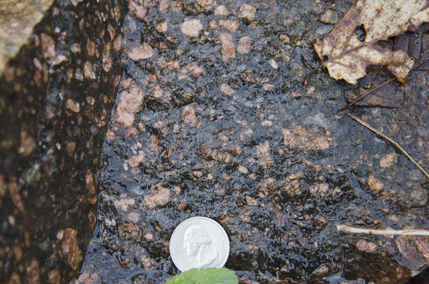
Moving on, we come to the aforementioned granite pluton:
Outcrop of Butler Hill Granite with swarm of mafic enclaves.
This is the Butler Hill Granite, a large granite pluton that extends from here all the way to Farmington and points south. In outcrop, it’s not too different from the Graniteville Granite at Elephant Rocks – maybe a little grayer and not quite so coarsely grained. The real feature of interest here are the mafic enclaves. These are pretty stretched out, which tells us that this granite was still convecting vigorously as it cooled. This swarm of mafic enclaves occurs near the outer edge of the Butler Hill granite. As we walk further down the trail and deeper into the pluton, they all but vanish.
That’s as far along the trail as we’ll go for this post. As the trail winds along Pickle Creek back towards its source in the Lamotte sandstone, it takes us along scenic but geologically bland terrain. But before we return to the trailhead, let’s take a peek at the kinds of rocks we can see in the creek. Sometimes, we can find stuff from outcrops that are small, hard to find, or even eroded away completely. Looking at these rocks can give us a slightly better understanding of unit relationships, even if they don’t tell us much about the specifics. Here’s what a couple minutes of looking turned up:
Float Rock #1
First we have a bunch of alkali feldspar crystals in a much darker groundmass. This appears to be a rhyolite porphyry, or a magma that was cooling and beginning to crystallize alkali feldspars before it erupted. Once it erupted, the lava was quenched, which made the groundmass much more finely grained. It could also be another example of a rapakivi dike (a few of the crystals there have the reaction rims) which contains enough iron oxide to turn it dark brown upon weathering. Since this was a state park, I didn’t bring my hammer to expose a fresh surface, which probably would have been helpful here.
Float Rock #2
Here’s an interesting rock that looks like it could be a large mafic enclave. A narrow red dike cuts through it; this appears to be an igneous rock of a type called aplite. Aplite is made up of extremely fine grains of quartz and feldspar. It’s generally found in small dikes less than a meter or so in diameter (although I’ll be showing off an exception in an upcoming post), and the general composition suggests that it’s the last bit of magma to solidify in a cooling granite pluton. Crystalline growth squeezes out this remaining melt into the surrounding rock, where it rapidly cools. Interestingly, we can see a small chill margin along both sides of this dike, which is a bit unusual for one of this size. Perhaps it’s an offshoot of a larger dike that was once nearby that kept it somewhat warmer.
Float Rock #3
Our last creek boulder isn’t igneous, or even part of the St. Francois Terrane. It’s a piece of early Cambrian Lamotte Sandstone, but this particular piece is a bit unusual. The Lamotte is generally a pretty clean sandstone – it looks a lot like decorative flagstone in many of its outcrops. Here, though, it’s cut by small quartz veins, so of which have a darker boxwork vein texture. These are likely associated with small Devonian-aged diatremes (the Avon Diatremes), one of which can be found less than a kilometer away.
Anyway, that’s our trip through Hawn State Park. A bit longer than most of our trips, but there’s a lot of ground to cover here!