Over our last few stops, we’ve gotten a look that the rocks that broadly represent the different levels of the St. Francois volcanic systems. Now we’re going to check out variations on that theme that refine the rough picture of what was going on. Today’s stop will be at Hughes Mountain, an underrated geologic treasure of southeastern Missouri.
Hughes Mountain rises to the grand altitude of 366 meters (1201 feet), which approximately 115 meters (380 feet) above the floodplain of the Big River. Both are barely deserving of their titles; Hughes Mountain is short even by the region’s standards, nor is the Big River much more than a modest stream. Nonetheless, the summit of Hughes Mountain is a spectacular treat for hikers and geologists alike.
The mountain is named after John Hughes, who moved into the region sometime between 1806 and 1810 when Missouri was still part of the Upper Louisiana district. His family farmed the floodplain to the southeast of the mountain and owned a mill that operated along Big Creek. His son Mahlon purchased the land outright in 1861, shortly before the Civil War arrived in Missouri. Despite being on privately-owned land, the location was a popular picnic location for locals. The area remained in possession of the Hughes family until 1982, when it was purchased by the Missouri Department of Conservation to develop into hiking area.
Hughes Mountain is typical of the large hills in southeastern Missouri – steep sides on the lower reaches and a gently rounded summit plateau. This is because, like many other large hills in the region, Hughes Mountain is composed almost entirely of erosion-resistant volcanic rock. In fact, if we look at a topographic map, we see that Hughes Mountain is simply the tallest part of a larger, locally prominent topographic feature:
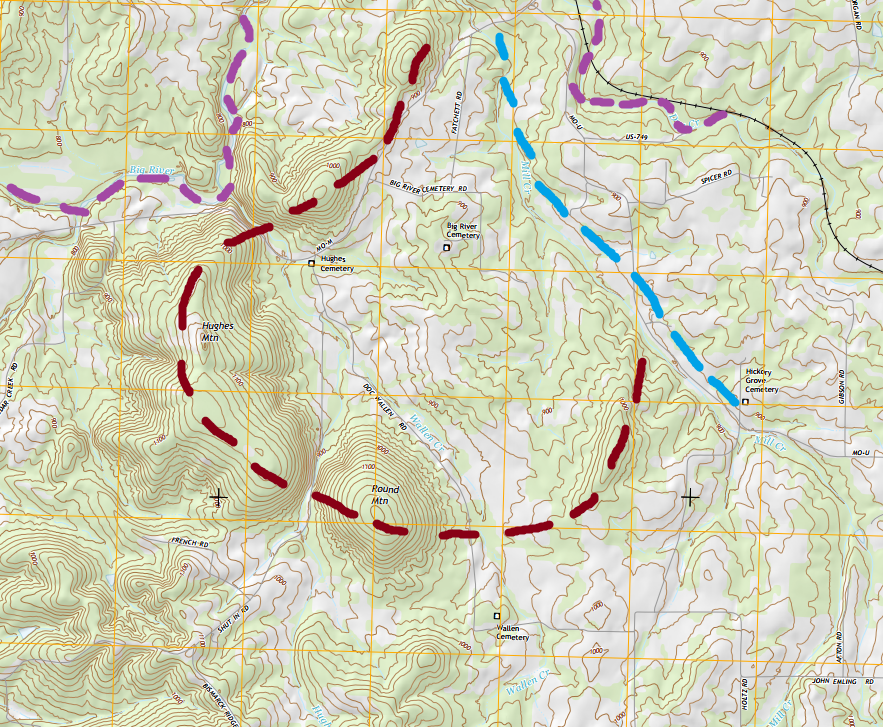
In addition to the curved hills, it’s really important to note that nearby Mill Creek has an exceptionally straight run compared to other stream systems in the area. Straight runs like this are often associated with fault lines, because the shattered and powdered rock that develops during fault movements are easily removed by a running stream. In turn, this prevents the stream from meandering around very much – after all water seeks the path of least resistance, and the easily eroded fault rock is by far the least resistant. When the chain of hills and the straight run of Mill Creek are taken together, we see a roughly circular outline emerge. It’s likely that this area represents a relatively small caldera, or is a subsection of a larger caldera, the Taum Sauk caldera, which is located to the south. (The granite we saw at Elephant Rocks, the Graniteville Granite, was the magma chamber underlying that caldera.)
Now for a curveball: the chain of hills are probably also sitting on top of faults. The obvious question, in light of the last paragraph, is naturally “but if fault rocks are easily eroded, then how to you get big hills sitting on top of them?” To answer that, we need to take a look at how the faults formed. In a caldera-forming eruption, so much of the volcano’s magma chamber is emptied that the rock overlying the magma chamber (called the roof) is no longer capable of supporting itself. It collapses, creating a ring of faults. After the collapse some of the remaining magma can flow along these faults and erupt onto the surface as lava. Since felsic lava is very hard, the segments of fault that hosted eruptive activity are marked by hills.
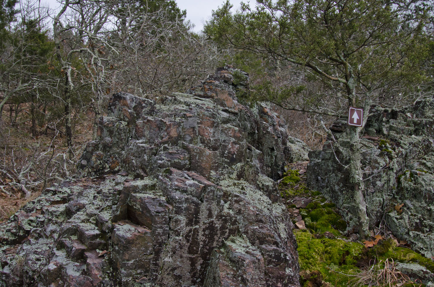
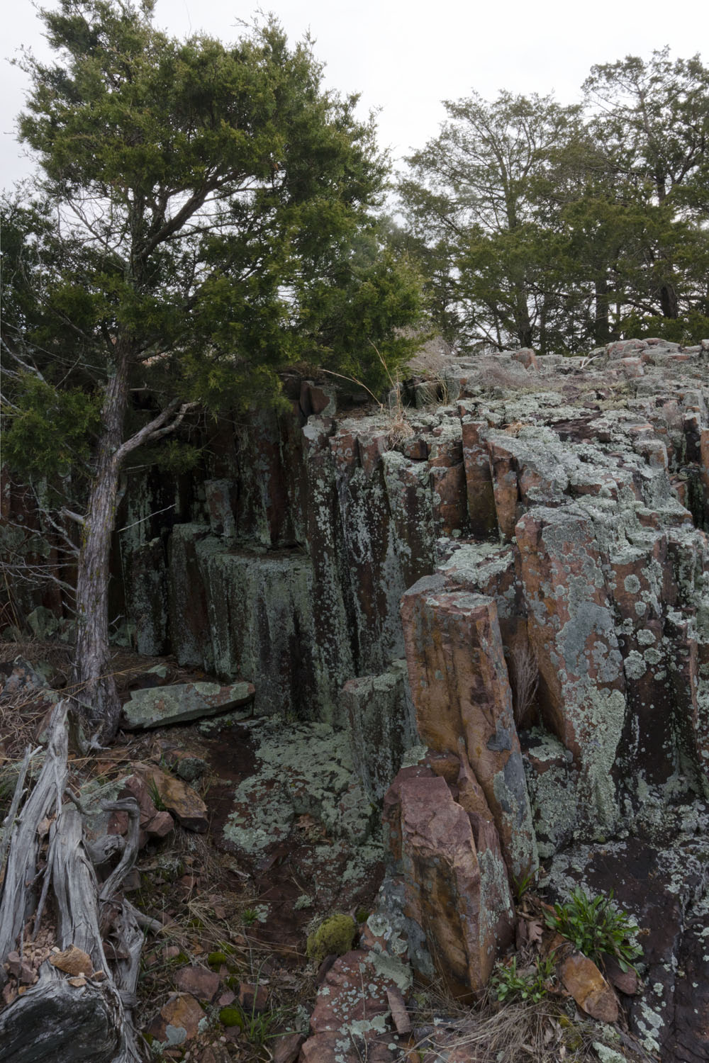
As we start a climb of Hughes Mountain, it becomes immediately obvious that these hills were made from lava. Less than a quarter mile from the parking area, we see our first exposures of rhyolite:
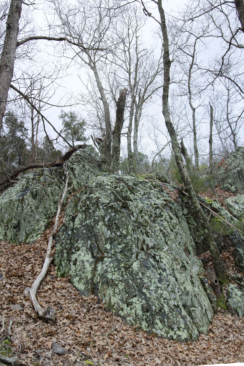
Here on the lower reaches of the mountain, where trees provide plenty of shade, moss and lichens completely cover the rock. We’ll see less of that as we continue our ascent. Climbing the winding trail through these cliffs is the most difficult part of the trail, after this it levels out quite a bit. When it does we’re greeted with a rhyolite glade that creates a small overlook area.
Taking a closer look at the rocks, we can see that there seems to be a slight geometric regularity to the fractures in the rock…
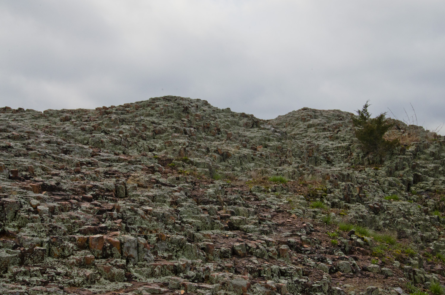
Continuing on, the trail begins to behave like a giant’s staircase. There will be a short incline, followed by a relatively flat walk before the next incline. This is an expression of the internal fracturing of the rhyolite flow (or flows) that make up Hughes Mountain. Although rhyolite is resistant to erosion, that doesn’t mean it can’t erode. It’s likely that a hundred meters or more of rhyolite have been eroded off Hughes Mountain since it formed. As the weight of the overlying rock is removed, rhyolite has a tendency to crack into large sheets. Geologists call this “exfoliation jointing”. The inclines are where dirt has collected at the broken edges of sheets, while the flats are the top of these sheets.
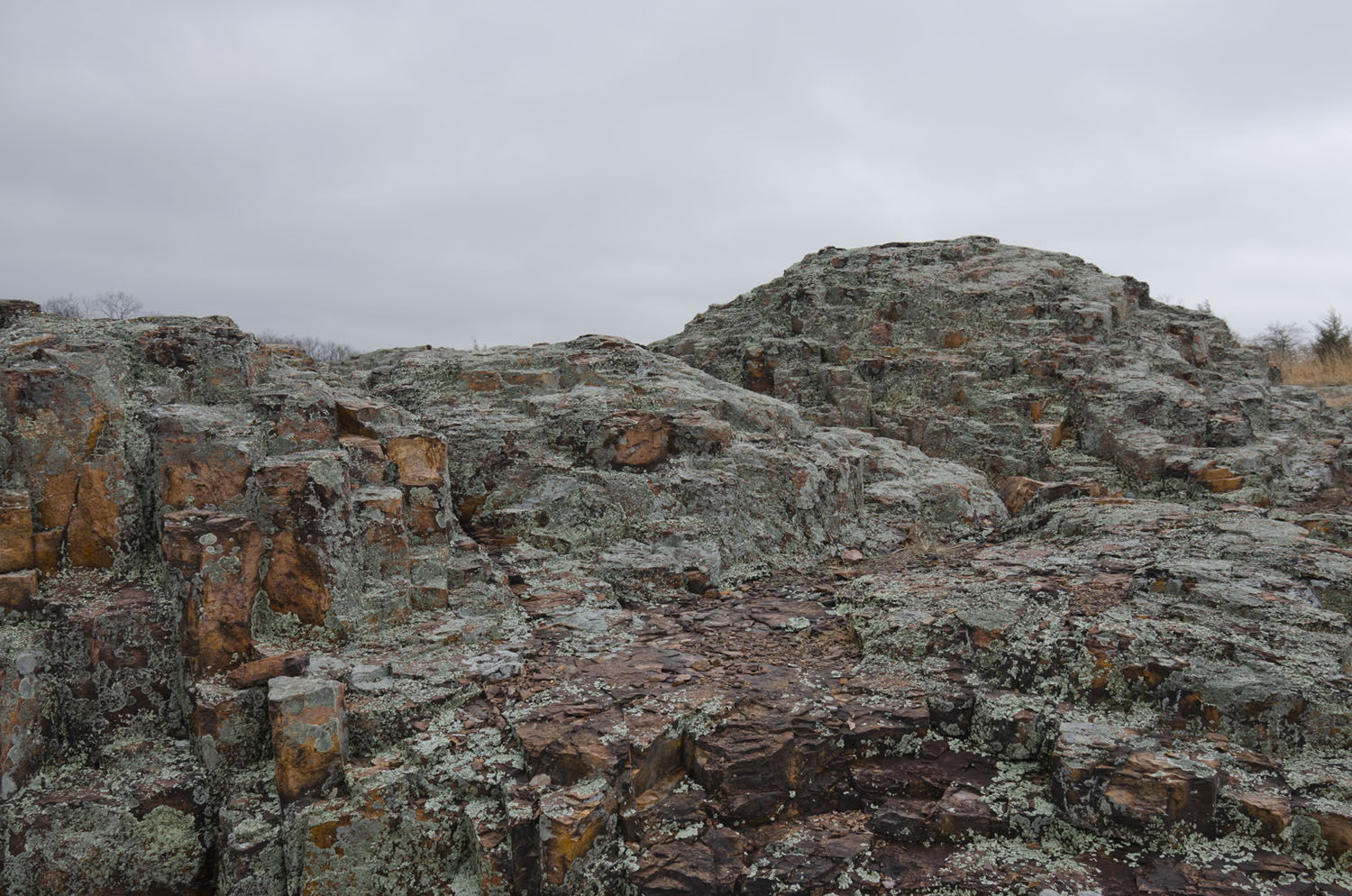
After about 45 minutes of walking, we reach the summit area:
The summit region hosts the geologic wonder known as The Devil’s Honeycomb. Here the rhyolite has cracked into polygonal columns. This is known as columnar jointing. Columnar joints form as the result of internal stresses in a lava flow as it cools. Hot lava takes up more volume than hardened lava, so as a lava flow cools it contracts and cracks. If the cooling takes place slowly enough, the cracking can develop in a regular 5- or 6-sided pattern, hence the name “honeycomb”.
Probably the most spectacular examples of this kind of jointing anywhere in the world are Giant’s Causeway in Ireland and Devil’s Tower in Wyoming, among others. However, those and almost every other example in the world are developed in basaltic lavas. The columns that we see here are in rhyolite. As it turns out, this nondescript hill in Missouri is a rarity – it’s one of the bare handful of places in the world that columnar jointing has formed in rhyolite. So why is columnar jointing in rhyolite so rare?
I’m not exactly sure of the answer to that question, but I’ll take a stab at it. The temperature of the lava is probably the main factor. Basaltic lavas tend to erupt at higher temperatures to begin with, so it takes them longer to cool off, giving columnar joints more time to develop. An additional factor might be the thermal conductivity, or the ability of the rock to move heat. Basalt moves heat fractionally more slowly than rhyolite, which would give it an additional advantage in the kind of slow cooling needed to develop jointing. The lava that erupted to form Hughes Mountain may have been especially hot, or the lava flow that formed its summit region especially thick.
Devil’s Honeycomb is a layer of columnar jointing that’s best developed in the top 45 meters (150 feet) of Hughes Mountain. Where the trail spits out into the summit glades, the jointing is very poorly developed. As we climb higher towards the summit, the jointing gets more and more prominent. Since jointing is poorly developed in faster-cooling areas, that suggests that we’re close to the bottom of this particular lava flow. And since the summit is in the best-developed jointing, it’s another sign that there’s been significant erosion into this pile of rhyolite. But I’m getting ahead of myself a little. Let’s back up and take a closer look at the rocks here:
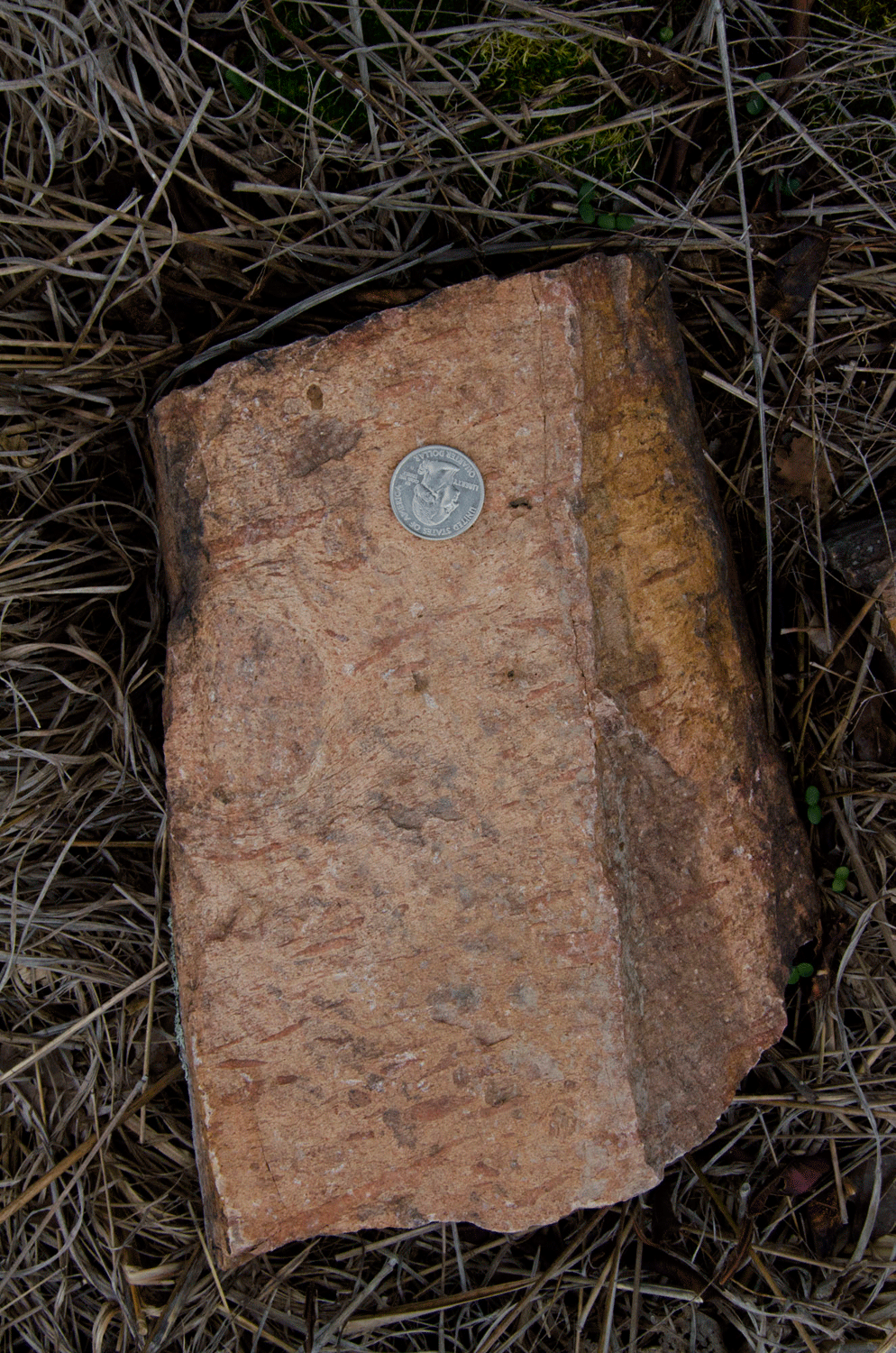
The rhyolite has well-developed flow banding. Rhyolite tends to be a gassy rock, but due to the silica content it’s also thick and pasty. When rhyolite erupts, the release of pressure allows the gas to escape from the melt, forming small bubbles. However the high viscosity of the rock also prevents that gas from escaping, so it forms small bubbles. The lava is flowing very slowly, and the flow of the rock tends to concentrate these gas bubbles into sheets parallel to the direction of flow. These sheets are known as flow bands.
Interestingly, we have a rounded pebble (or clast, in geology-speak) that’s also included in this piece of rock. Clasts like this make great shear-sense indicators, telling us the relative directions within the rhyolite flow. If a sheet of lava is moving faster in one direction than another, flow bands will pile up on one side of the clast, and be relatively absent on the other side. In the picture above, we can see that the clast was experiencing right-lateral (sinistral) shear – that is in a plane dividing the clast in half, the upper half was moving right and the bottom half was moving left. (In reality, all of the lava was probably moving right, but the top was moving right faster.) A smaller clast at bottom seems to indicate an opposite direction of shear, so the middle third of this rock was probably not moving very much, while the top and bottom thirds were sort of flowing around it.
Some other rocks have a lot of little white flecks in them:
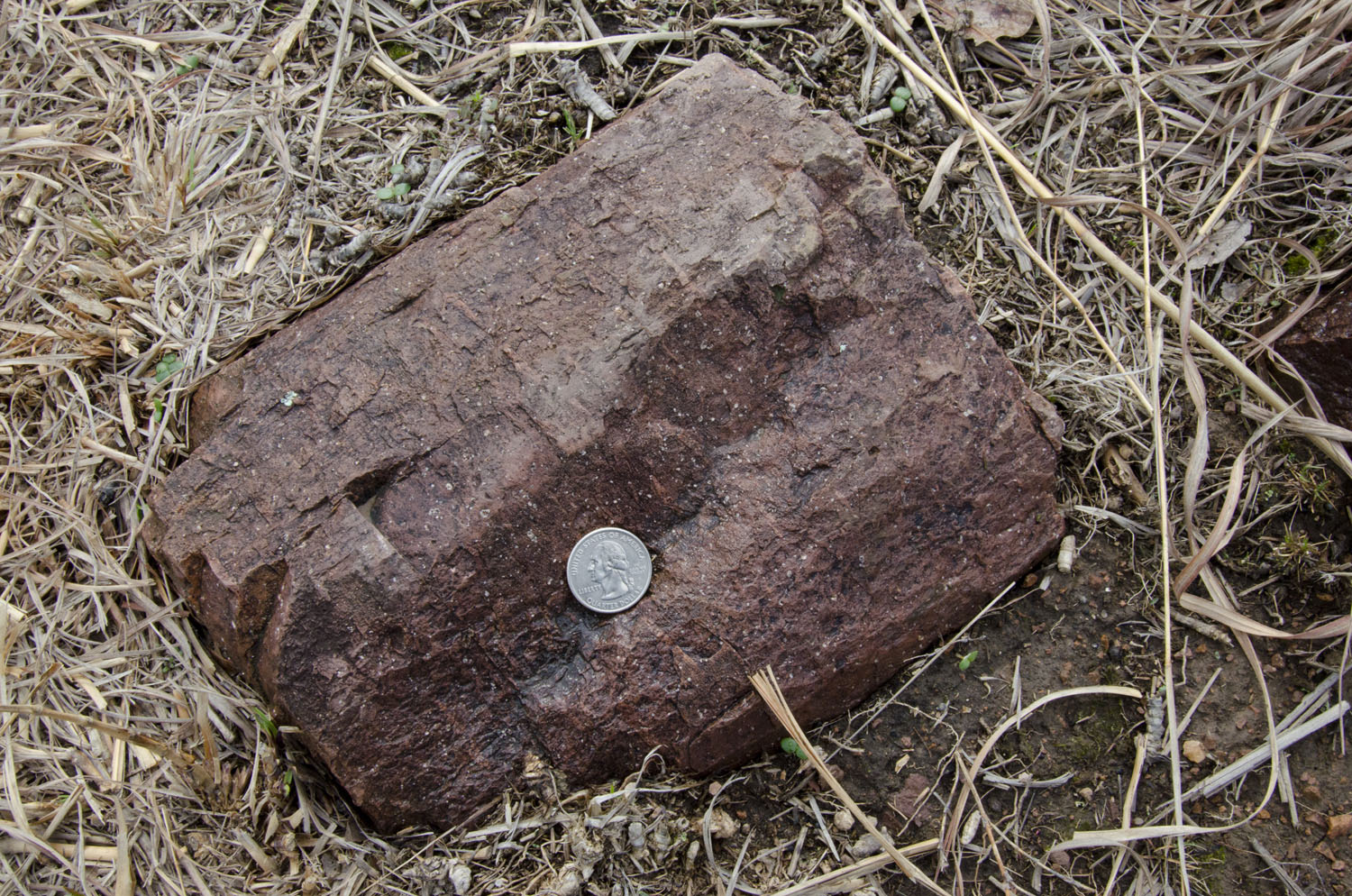
These flecks are spherulites. Spherulites start their lives as a glass with an unordered (amorphous) molecular structure. As the lava flow cools, the heat available allows the molecular structure time to reorganize itself into a more regular (crystalline) molecular structure. The end product are these small white beads. The size of these spherulites in this specimen are about the same size as those found in rhyolites (with a few exceptions) throughout the St. Francois area.
Now back to talking about the summit:
It’s near the summit that you find the best rhyolite columns. Lower down the slopes, the columns are somewhat irregular and stubby, but near the summit they grow a good meter or so in height and have more regular polygonal shapes. The best exposure is the summit itself: a massive pile of hexagonal columns:
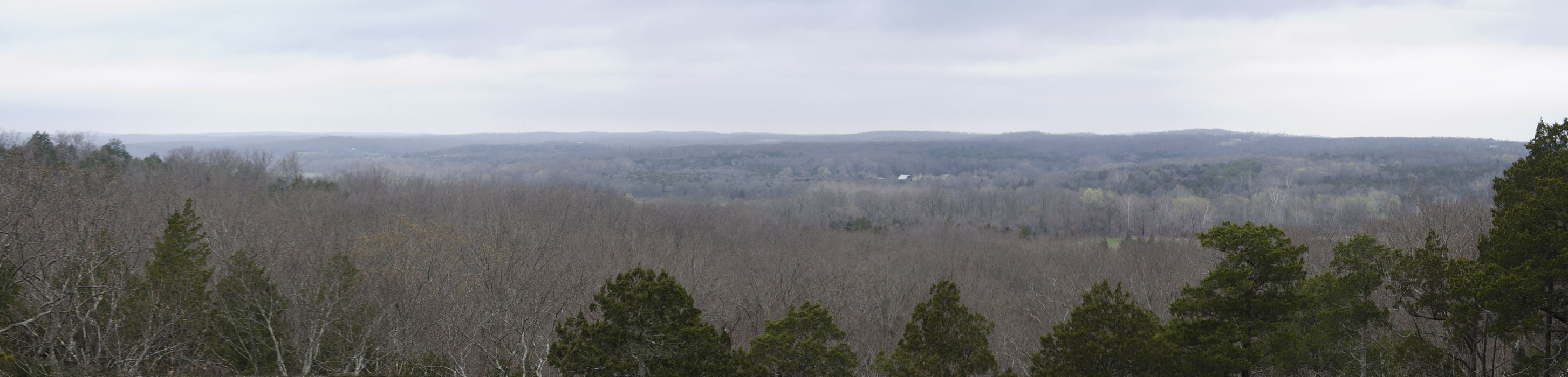
While the geology is spectacular, so is the view:

No wonder this area was such a popular picnic site. The wind blows gently, not slowed by hills or forests. Despite the unassuming altitude, the temperature’s dropped a couple of degrees from the surrounding floodplains. Small patches of pine provide ample shade should the Sun get to be too much.
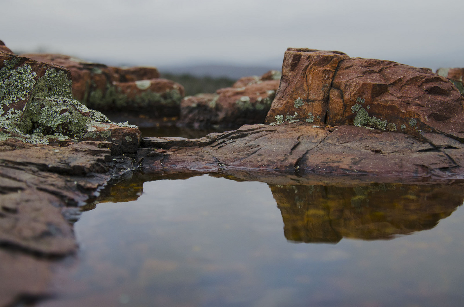
I’ll end this post with a shot that shows that the landscape of Hughes Mountain is beautiful at every scale: