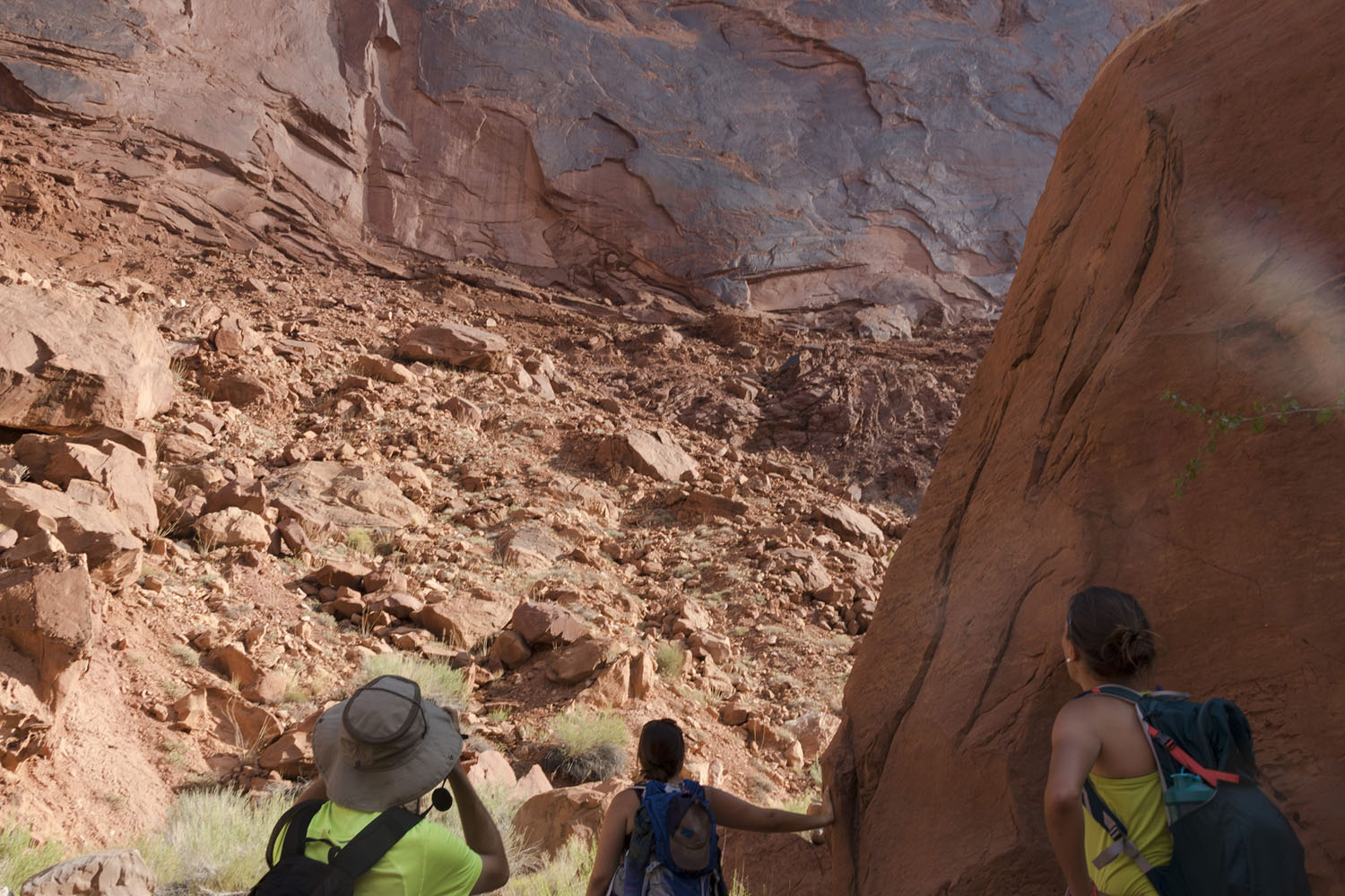
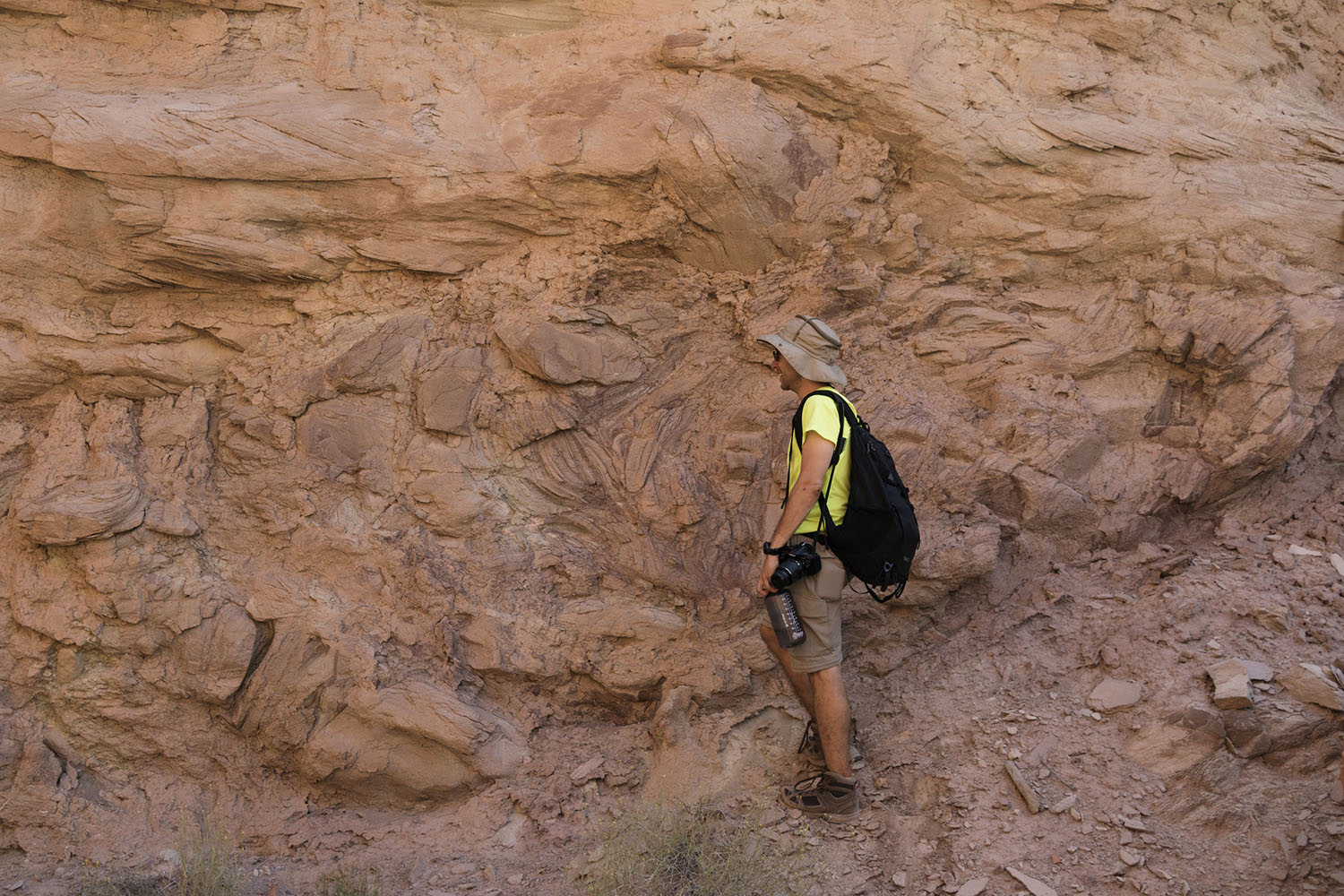
This page describes a field trip to Upheaval Dome that I took with with a group from Stony Brook University in late August 2017. For those of you familiar with the Utah summer the timing might sound ill-advised, and you'd be right. There were a few factors driving this decision, and in hindsight going forward with it was a bad idea. I have a photo that pretty much sums up the trip experience:
But in between darting between shady overlooks in an effort to stave off heat stroke, we saw some incredible geology. There is some debate on whether Upheaval Dome is an impact crater; prior to the trip I was on the fence. After coming back, I'm a firm believer that it is indeed an impact structure. The rock there has been deformed in extremely interesting ways, and I am already itching to return some (much, much cooler) day and look at the place in more detail than we were able to during this trip.
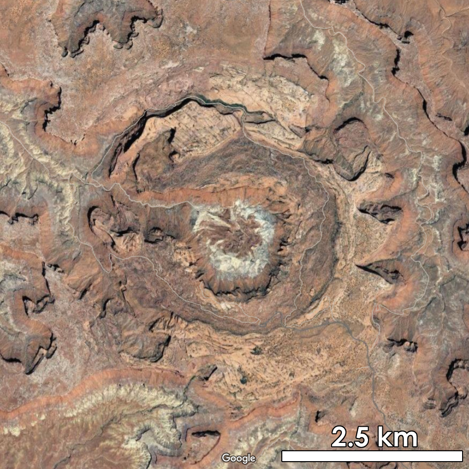
To provide a bit of background, Upheaval Dome is an approximately 5 km wide structure located in Utah's Canyonlands National Park. From above, it looks like this:
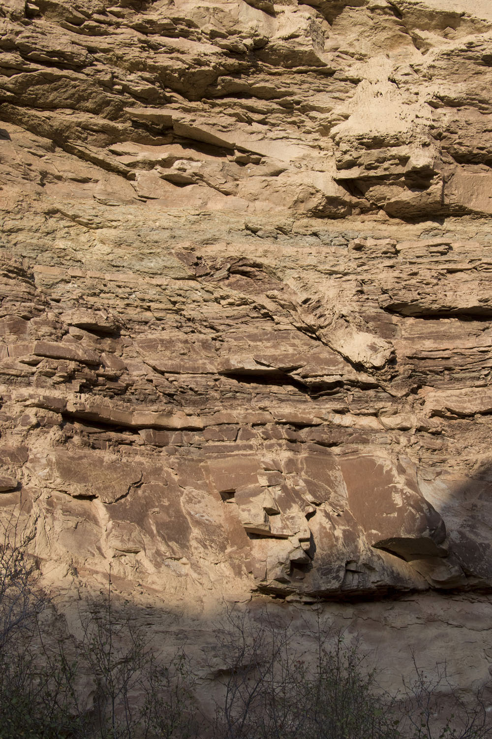
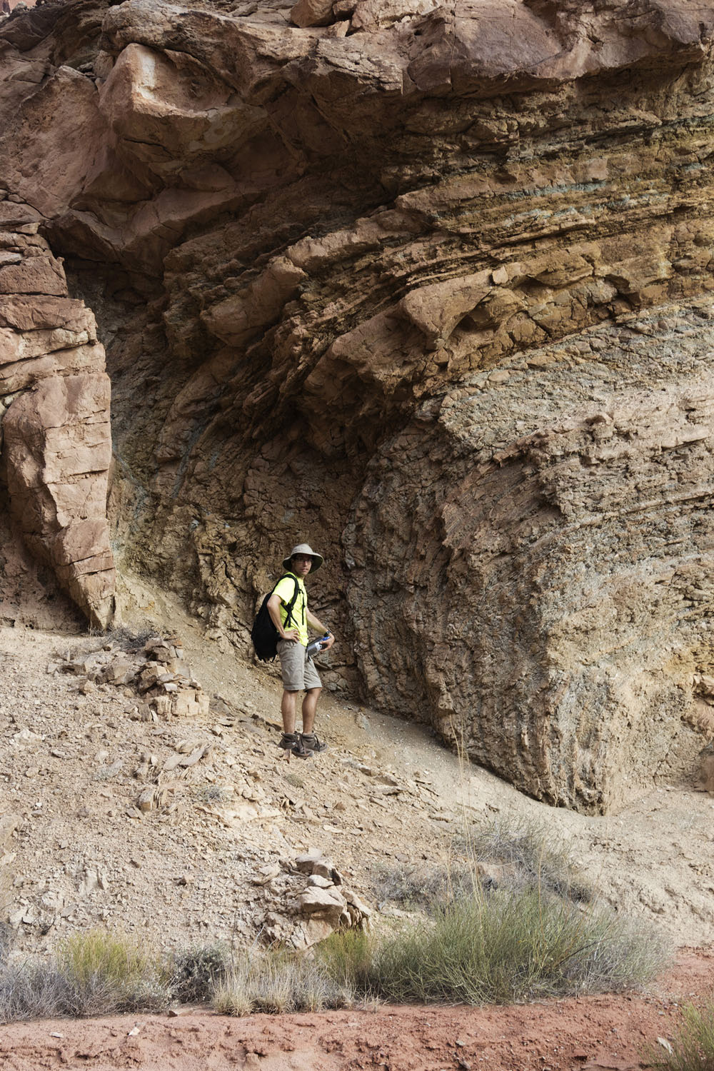
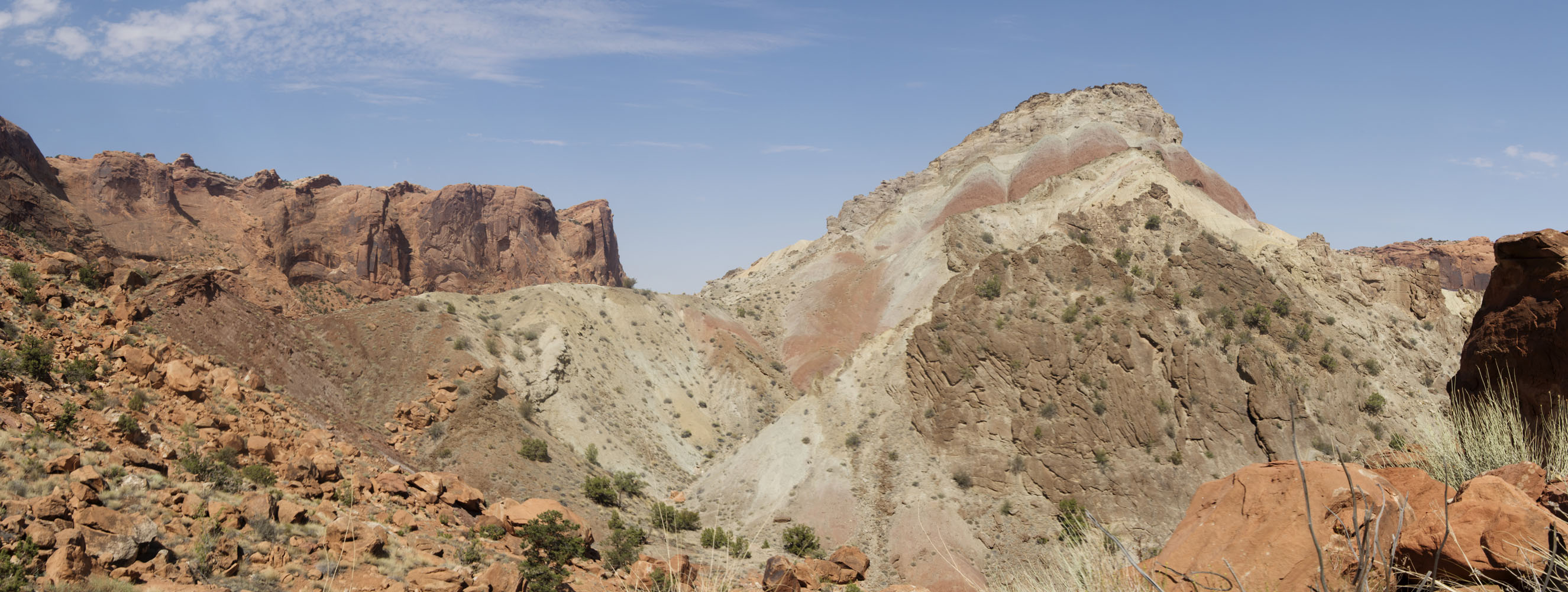
Structurally, this feature is a dome with rock units at the center uplifted roughly 200 m above their stratigraphic position outside the crater. The rocks uplifted around the center are relatively weak shales and thin sandstones, which have been eroded out to form a central pit. Rim rocks are folded into a relatively tight syncline. Quickly going through the stratigraphic sequence of rocks: at the rim are small erosional remnants of the Kayenta sandstone, underlain in order by the massive Windgate sandstone, colorful shales of the Chinle fm, the thinly bedded sandstones of the Moenkoepi fm, and at the center of the pit, a brecciated mass containing fragments of the Moenkoepi fm mixed with the White Rim and Organ Rock sandstones of the Custer fm. Here's a photo from part of the hike that shows most of the sequence visually.

In years past, Upheaval Dome has been traditionally associated with a salt diapir derived from a 1.6 km thick sequence of evaporites (the Paradox fm) which underlies the park. Salt is an incompressible mineral that is much less dense than clastic sedimentary rocks. When buried under enough sediment, the salt begins to flow upwards, forming columns and sheets that deform the surrounding rocks. Evidence of salt motion can be found in the Canyonlands Needle District, about 35 km to the south. There the movement of a salt sheet has stretched the White Rim sandstone, forming a series of shallow, parallel grabens (downdropped fault valleys).
However, starting with Kriens et al, 1998, geologists began to reinterpret Upheaval Dome as the deeply eroded remnant of an impact crater based on its structural similarities to other known impact sites. However, many lines of evidence were equivocal until the 2008 discovery of shock deformation features in mineral grains by Buchner and Kenkmann. I'll admit here that I was still skeptical this showed an impact origin, since these grains are apparently much harder to find at Upheaval Dome than most craters. Given their rarity and a lack of a similarly intensive search from the rocks outside of the crater, my view was that they might have just been grains from another impact site that were brought in as part of the sedimentary mass.
One driving factor for our visit to Upheaval Dome was to look at the crater rocks up close, especially those in the breccia at the center of the dome. As someone who now works on Martian geology studying the structural relationships of heavily eroded craters, especially one formed in a sedimentary sequences, was particularly appealing.
We departed the Syncline Trail parking lot at around 6:15am, just as dawn was beginning to break. Our traverse plan was to follow the Syncline Trail around to the campground, cross the central mound, and then exit by climbing a notch in the rim that met the Syncline Trail near the parking lot. This route had been previously used by mappers working in the crater, but unbeknownst to us, a rockfall had blocked this exit route in the year since the last mappers had worked there.
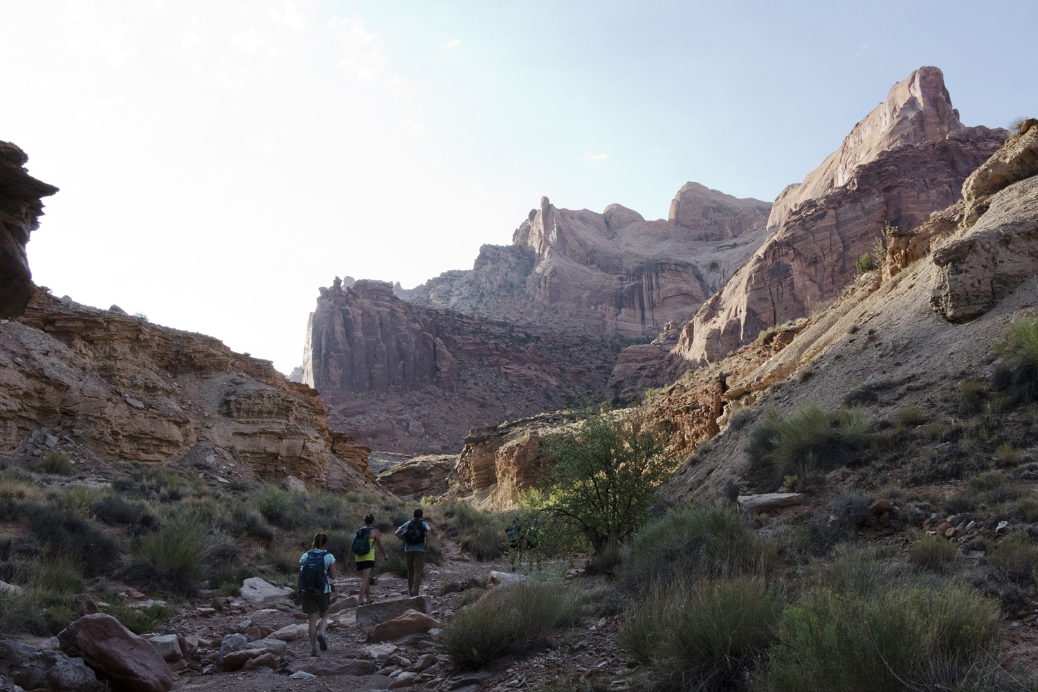
The first part of the hike was uneventful, but took us across some spectacular scenery before dropping us into one of Canyonlands' namesake side canyons, which I called "Syncline Canyon".
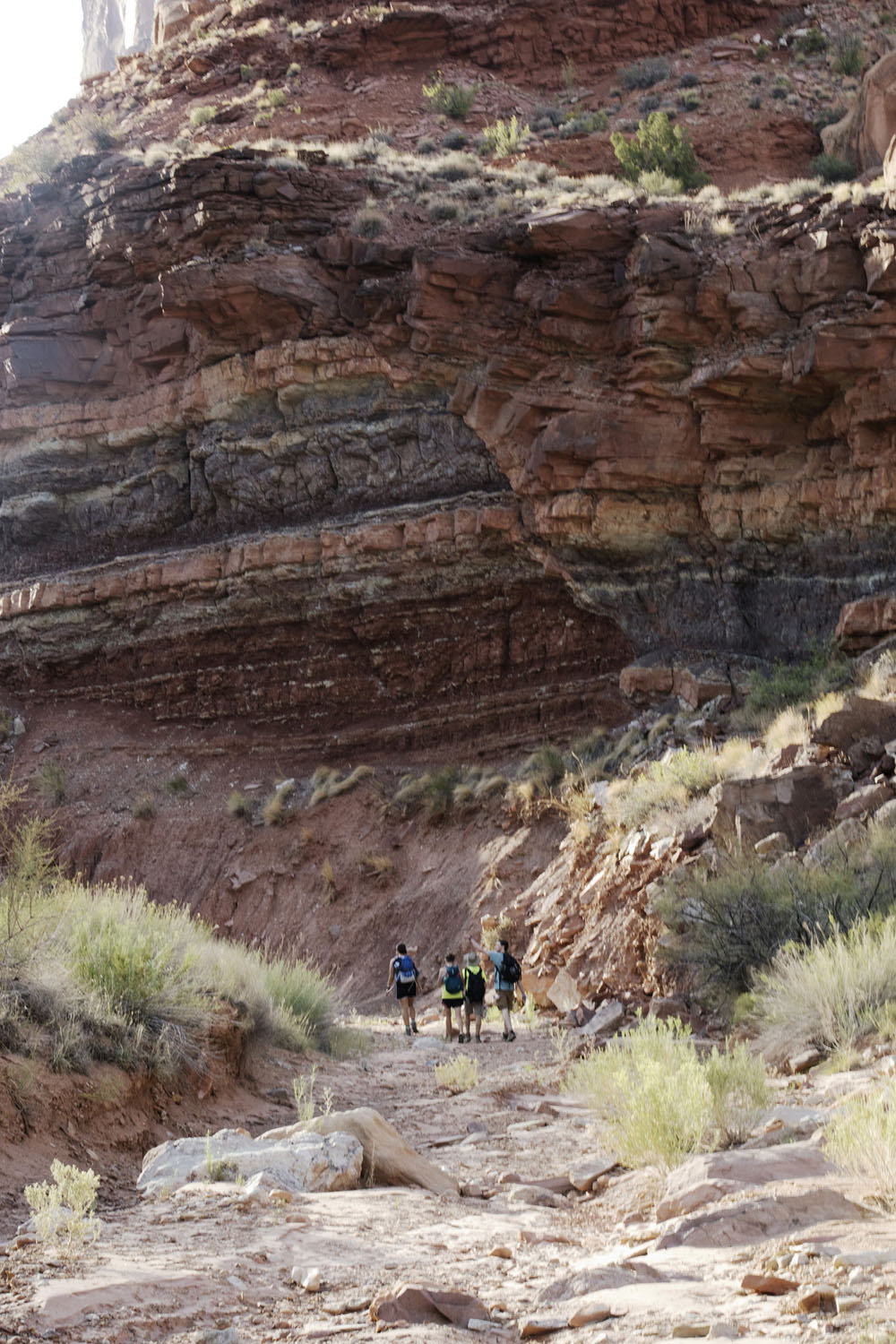
The hike along the bottom of the canyon provided a very nice look at the Chinle formation. Not much deformation was visible, with the exception of the occasional fault. We didn't have time to stop for measurements on these faults, but my sense was that there wasn't an obvious consistent set of motions on these faults - some were very steep reverse faults, others were relatively shallow normal faults. Because the canyon we were in was circumferential to the dome's center, the fact that these faults were exposed at all suggests they were radial to the dome's center.
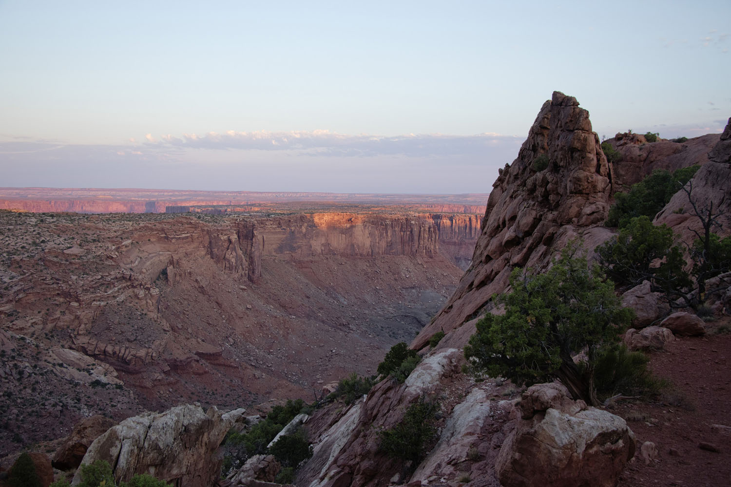
We reached the Syncline Campground at approximately 8am. The campground's view of its namesake syncline is amazing.
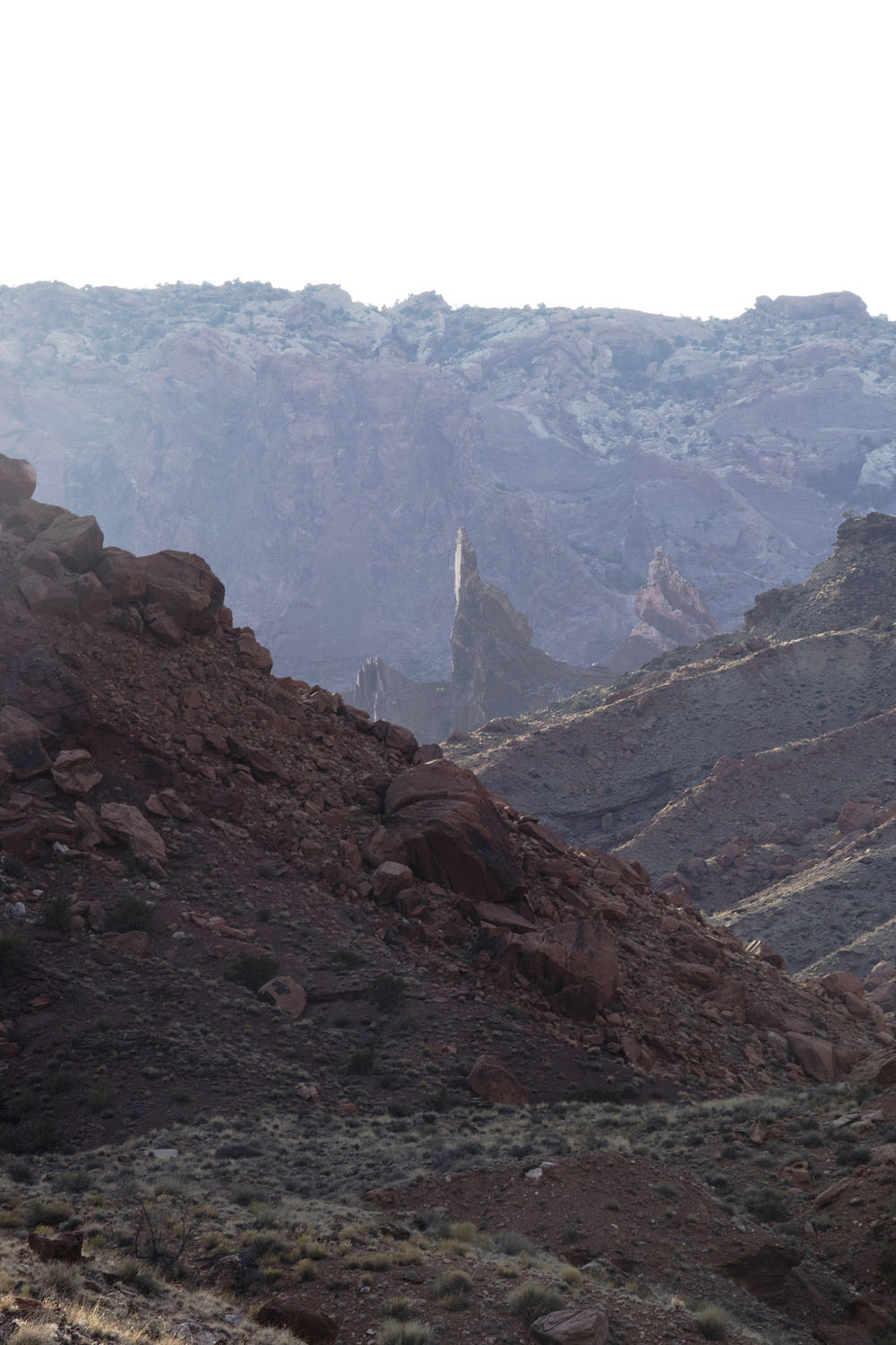
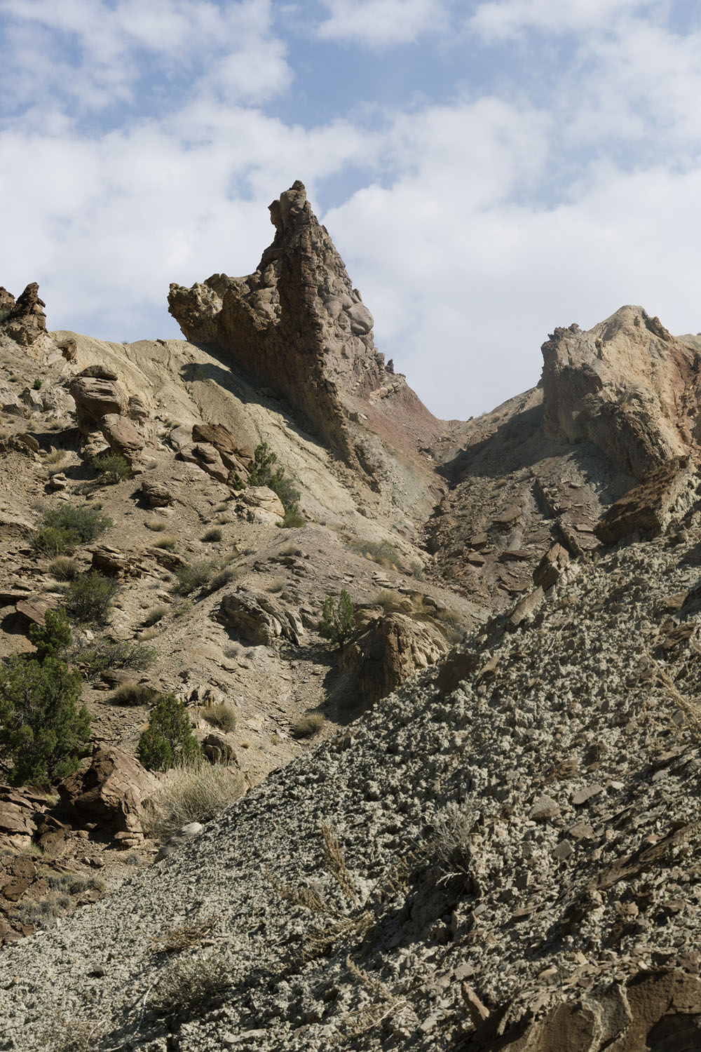
From the Syncline Campground, we followed the canyon that cuts through the rim's western side, or as I called it, "Entrance Canyon". It was along this section of our traverse we got a good glimpse of the breccia unit at the dome's center. I remember how much seeing the breccia spires reminded me of Mordor - and in hindsight that comparison feels very accurate.
Further up Entrance Canyon, we came across a very large normal fault in the Chinle fm that might be related to the fold axis of Upheaval Dome's syncline. The offset looks small from a distance...
But a lot larger once you get close to it!
As Entrance Canyon begins to open into the central pit, we came across a fairly large thrust structure where the brightly colored shales in the lower Chinle formation were pushed upwards into the muted brownish shales of the upper Chinle. The general thrust direction was outwards from the dome center.
The tension cracks opened up by the process of folding were heavily mineralized. After some discussion we tentatively ID'd the fracture mineral as calcite, as none of us could scratch it and we got some weak fizzing in an acid test. The effervescence wasn't super strong, so we weren't extremely confident in the result. Gypsum is one possibility, since gypsum vein networks with a similar density are relatively common in the Moenkoepi fm. With the intensity of fracturing here, it would not be surprising for saline groundwater to have mineralized this outcrop.
One of the first things I saw that started to convince me that Upheaval Dome was an impact crater was a duplexed slab of Chinle formation that had been injected into the lower portion of the Wingate sandstone. Although brecciation is common along the boundaries of a salt diapir, to my knowledge a thrust structure like this would be extremely unusual.
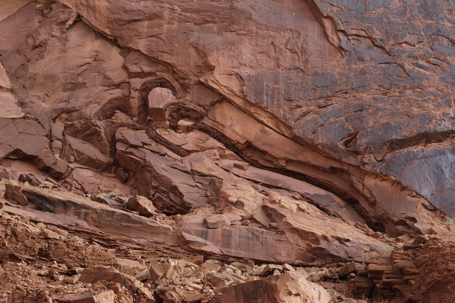
Unfortunately I don't have a great sense of scale for this, since it was located high up on the rim. Guesstimating from this wider shot, I would say the duplexed feature is 2-3 meters tall, with an associated disturbed zone that extends up to 10m into the bottom of the Windgate. The massive nature of the Windgate also makes it hard to observe deformation, so it is possible that there is severe internal disruption that we couldn't see from our location in the dome's central pit.
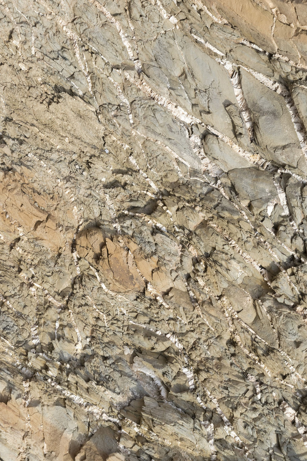
The thing that sealed my belief of an impact origin was this outcrop we stumbled across. Here the internal layering of the Chinle is still observable, but highly disrupted. In ways, this rock looks like it has been brecciated, but there are also flow-like qualities to the deformation. It doesn't look like any type of breccia I have ever seen. The salt breccias I've observed are more pervasively fractured and have occasional pockets where loose material has filled open space between broken pieces of rock.
Our resident impact expert Steven suggested that this breccia might be an example of acoustic fluidization of the rock near the instant of impact. During this instant, the shaking and shock pressures are so intense that the bulk rock briefly behaves like a fluid. This would explain the flow-like patterns in the rock. As the shock pressures decrease but the shaking is still violent, the rock can fracture, causing the numerous small displacements we see between chunks of the breccia.

Shortly after finding this outcrop, we entered the brecciated mess of the central mound region. By this time it was about 9:30 am and the light wind was beginning to carry in hints of the day's heat to come. Our main task was to navigate our way across the rugged terrain so we could get to the exit route on the rim. At this point the group started moving at a pace that was a little difficult for me to keep up (I'm a slow hiker even in the best of times), so I don't have very many photos of this part of the traverse. But here's one that gives a sense of how rugged this traverse was:
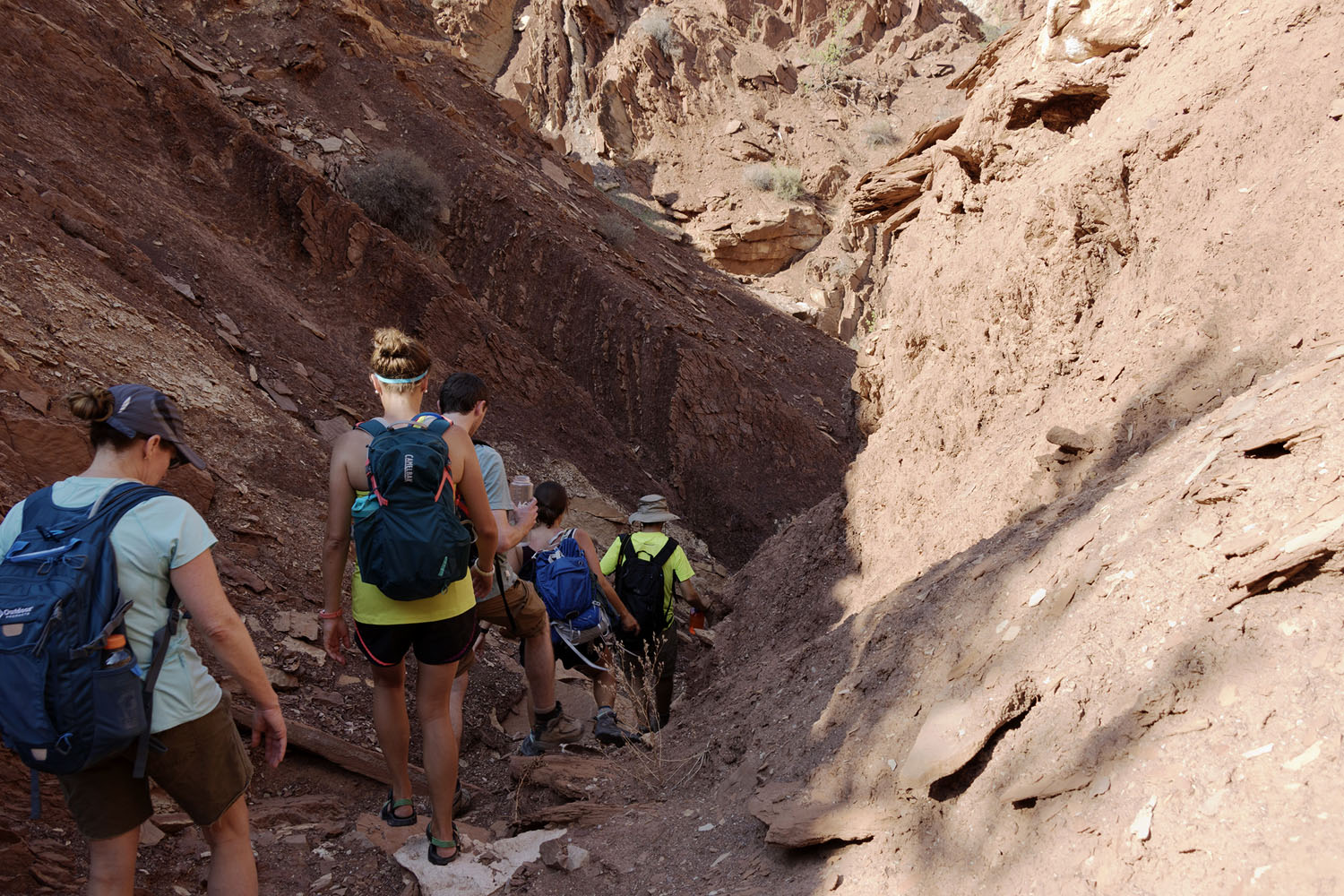
The trek was made harder by the talus - the blocks were small enough that you were tempted to move quickly, but just large enough to catch a foot and roll your ankle. Climbing talus hills in the growing heat was exhausting, so I had a couple of moments to take in just how messed up the rocks were in the central mound.
After nearly an hour and a half, we reached the bottom of the rim. The notch we had been told to look for was pretty obvious, but parts of it looked difficult to navigate. The two best hikers took a walkie-talkie with them and began the ascent to make sure the way was clear. The rest of us caught our breaths in the quickly vanishing shade along the southern rim. I used this moment to snap a panoramic view of the central mound, which turned out to be my last pictures of the day.
A few minutes later, our pathfinders radioed back that the way out was impassible. We immediately realized that we were stuck in a very dangerous contingency we hadn't really planned for. The hottest part of the day was still a few hours out, and it was already beginning to get uncomfortably hot. We made a decision to get back out the way we came, as quickly as possible. We managed to haul our way back over the central mound in about 45 minutes - we spotted a more traversible route from our vantage point high on the slopes above the central mound, plus we had sort of gotten our legs for hiking on the terrain.
We reached the Entrance Canyon at about 12:30 pm and took a short break to catch our breaths and down a quick lunch. The next segment of trail, covering the route from our position to the point where we dropped into Syncline Canyon, was roughly 2.5 miles of relatively flat hiking, which we figured would take about an hour to cover. With luck, we would be back at the cars before the worst of the heat set in. I don't think I realized at that point how much the heat had already sapped my strength - it ended up taking nearly 2 hours. One problem that I had unknowingly caused myself was that I didn't have enough electolytes packed with me. Although I had carried nearly 8 liters of water with me (which I knew I would use entirely), it was being absorbed into my system too slowly.
After we started our walk back from the central mound, my memory gets really hazy. Parts of it I remember very clearly - a couple in a situation nearly as bad as ours resting in the shade along the Syncline Canyon creekbed; a park ranger involved in a search for a missing hiker who would occasionally check in with us as he combed a grid; the sound of a search helicopter occasionally flying overhead; having to steel myself for the climb back up to the rim at the end of Syncline Canyon; the ranger giving me some salt candy on the hike out. At points, I just wanted to wait in shaded areas for the heat to pass, but the others were concerned about heat stroke or heat exhaustion settling in. I'm not exactly sure when we made it back to the parking lot, but it must have been around 5:30 or 6. By that point the candy and gatorade I had been gifted by the ranger were starting to take effect and I could feel my strength starting to come back a bit. That said, I was dead exhausted. My entire body hurt and I was ready for a quality sleep. I ended up heading back to our campsite while the others ate dinner, and slept for nearly 12 hours straight.
I am grateful for what I managed to see, and I've come back a little wiser. It isn't an experience I want to repeat again, but a location I definitely want to return to.
Page Added: March 30, 2020