Map
Physical Data
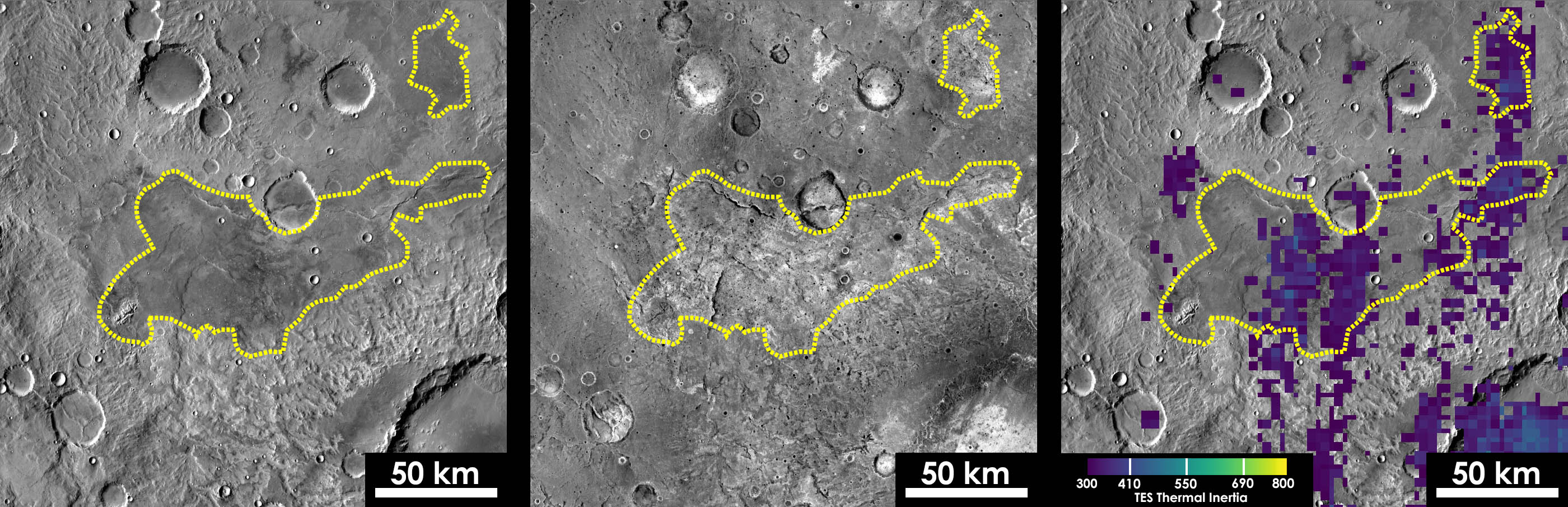
- Location: 5.8 S, 117.6 E
- Area: 6200 sq km
- Interpreted Age: Middle to Late Noachian (Tanaka et al. 2014)
- Other information: Contains putative chloride deposit mapped by Osterloo et al. (2010)
Spectral Data
Imaging Data
Relevant Literature
- Osterloo, M.M., Anderson, F.S., Hamilton, V.E., and B.M Hynek (2010), Geologic context of proposed chloride‐bearing materials on Mars, J. Geophys. Res., 115(E10), E10012, doi:10.1029/2010JE003613