The "Holey Tour" is an educational field trip originally developed by pioneering planetary geologist Ron Greeley during the late 80s to educate fledgling planetary scientists, and which became a yearly field trip at Arizona State University until his passing in 2011. The tour was designed to show off major surface processes observed to build and modify planetary surfaces, taking advantage of the diverse and densely-packed geological wonders of central and northern Arizona. Its name comes from the emphasis on recognizing the differences between various holes created by explosive volcanism and impact cratering. I participated on a shortened, one-day version of the field trip at the GSA Rocky Mountain/Cordilleran Joint Section meeting in May 2018. This trip was organized by Nadine Barlow, with Chris Edwards, Mark Salvatore, and Jean-Francois Smekens joining in to lead various parts of the tour. Despite the trip's shortened length, it was still an action-packed and exhausting day!
This field trip covers three (and a half) separate field sites, so this field trip has been broken up into three separate parts for easier navigation.
The terrain north of Flagstaff is dotted with several small stratovolcanoes and hundreds of small cinder cones which define the San Francisco Volcanic Field. This volcanically active region encompasses nearly 5,000 sq km (~2000 sq mi) of terrain. The volcanic activity in this area is something of an enigma, as unlike other volcanic fields in the Western US, it sits on the Colorado Plateau, which is a relatively stable block of crust. Several mechanisms have been proposed to explain the volcanism in this region, but determining the correct one has proven elusive. There seems to be a general consensus that volcanism has something to do with how the the gently flow of convecting mantle interacts with the deep crust under the Colorado Plateau. One major group of models suggests that a large piece of dense crust has "dripped" off the bottom of the Colorado Plateau, a process known as "delamination" (e.g. van Wijk et al. 2014). This piece of dense crust then forms a large barrier to mantle flow, which forces some of the mantle to flow upwards. As it rises, the reduction in pressure on the hot mantle rock causes some of it to melt, producing the magmas feeding volcanic activity in the field. Other models suggest that the transition between the thin crust of the adjacent Basin and Range Province and Colorado Plateau (which happens around the Mogollon Rim) forms enough of a barrier to induce decompression melting (e.g. Tanaka et al. 1986).
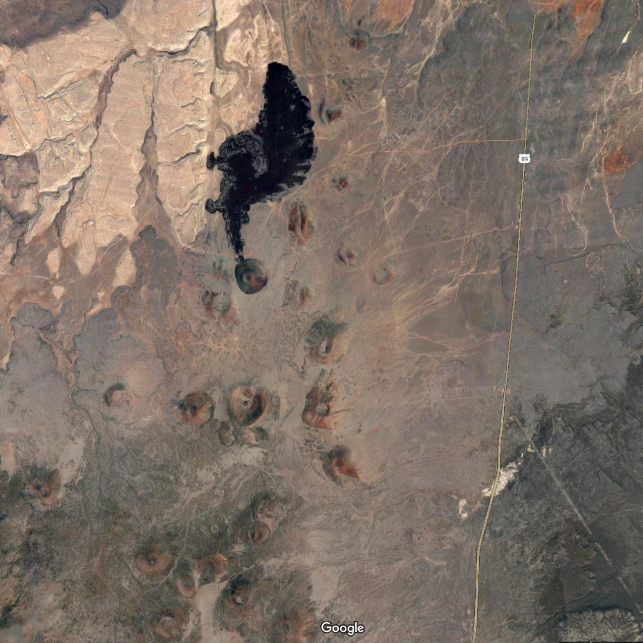
Regardless of the mechanism, faulting in the area has helped magma ascend to the surface. The volcanic field is mostly sandwiched between two large extensional faults: the Mesa Butte fault on its west and the Doney Fault on the west. Geochronologic work suggests that activity began along the Mesa Butte fault around 6 million years ago, and has slowly migrated east, with much of hte modern volcanic activity taking place near or along the Doney Fault (Tanaka et al. 1986; Conway et al. 1997). Many of the volcanoes in this area lie directly on these faults, while others form chains marking the locations of smaller branch faults. Two cinder cones, S.P. Crater and Coulton Crater, are found within a few kilometers of each other along a minor branch of the Mesa Butte Fault near the northern edge of the field. Both are largely composed of runny basaltic lava and produced prodigious amounts of scoria and cinders. But the two volcanoes show a dramatic difference in form, telling us their formations were very different processes from one another. The close proximity of these volcanoes provides a great chance to compare and contrast their structures. These two volcanoes also make excellent stand-ins for some small Martian volcanoes, which draws planetary scientists to the region for their studies.
This segment of the trip was led by Chris Edwards (NAU), Mark Salvatore (NAU), and Jean-Francois Smeckens (then at NAU, now at Oxford), who all specialize in applying remote sensing to geological processes. We first discussed S P Crater, a very young-looking cinder cone.
A large a'a flow starts at the crater's base, with the furthest reaches of the flow extending nearly 8 km north from the vent. American colonists moving into the area during the late 1800s noted its resemblance to a freshly spilled chamber pot, leading them to call it "Shit Pot". The USGS, reluctant to use swear words in maps for the public, abbrieviated the name to the less vulgar "S P". Not only does the crater have the appearance of a fresh toilet disaster, it has a fresh appearance geologically speaking. In contrast to many of the older cinder cones in the field, the summit crater's rim has a very sharp outline. Vegetation has had trouble establishing itself on the cone's flanks, with very little of the desert scrub managing to establish itself on the cone's flanks and none at all on the rough a'a flow at its base.
This method of relative dating led early geologists to suggest that S P Crater was among the youngest craters in the field, with perhaps only Sunset Crater being younger. However, when the lavas were tested with radiogenic dating, geologists derived an age of 71,000 years +/- 4000 years (Baksi, 1974). This timing is a topic of heavy debate, since craters of a similar age in the field have a much more degraded appearance. The technique used for dating, which measures the ratios of two isotopes of argon gas, is prone to atmospheric contamination. If this is the case, the measured age might be too old.
That said, several factors might lead to the volcano's appearance looking too young. First, the crater rim is topped by a layer of spatter, which erodes much more slowly than cinders. The spatter might serve as a cap, which helps slow the shedding of cinders from the cone's steep slopes. The cone's flanks also appear to have several small landslides near the base, telling us that the cinders are sitting very close to the limits of stability. Instead of being young, the occasional slip of material down the crater's sides may prevent larger vegetation from establishing itself. The crater's a'a flow very thick (between 10-15 m thick near the base of S P Crater, and more than 60 m at its end) and relatively porous - vegetation may be unable to establish itself because the precious little rainwater reaching this desert environment quickly slips out of reach. Vegatation has begun to establish itself on thinner parts of the flow near its edges. Finally, the very dark color of the cinders and lava turn the surface into an oven during the summer, baking any plants that start to grow on its surface.
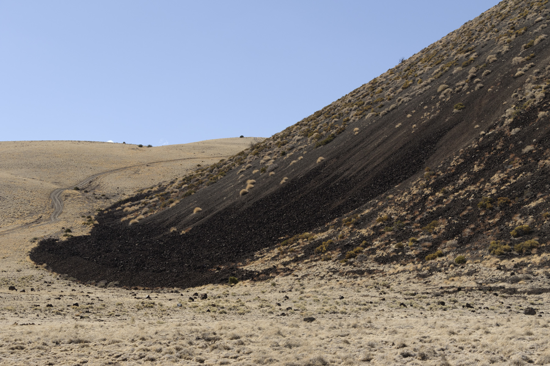
A small landslide on S P Crater's surface.
Regardless of its actual age, S P Crater is a great example of what a fresh cinder cone looks like. The sides of the 300 m (~1000 ft) high cone have a constant slope of 23 degrees. The summit vent measures roughly 400 meters (~1300 feet) across and has a maximum depth of about 60 meters (~200 feet). A useful measure of a volcano's shape is its aspect ratio, or the ratio of its height to diameter. This value can provide geologists with a sense of the volcano's shape. S P Crater's aspect ratio is roughly 0.25, which is a typical for a cinder cone. Another useful measure is the ratio of its vent diameter to the overall diameter, which gives geologists a sense of how explosive the volcano's eruptions were. This ratio is about 0.33, also typical for cinder cones.
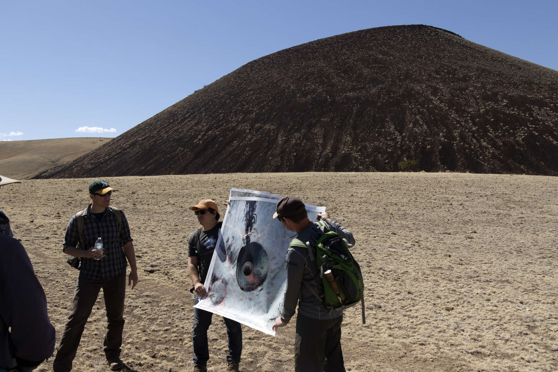
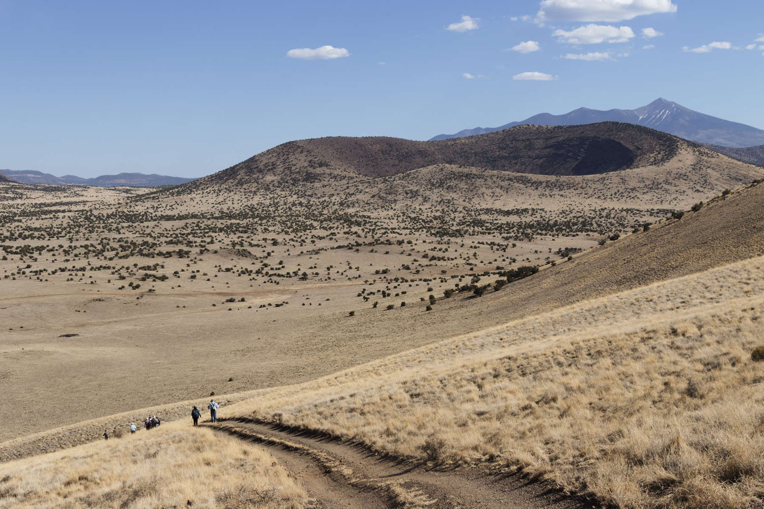
We then turned to discuss Coulton Crater (from a distance).
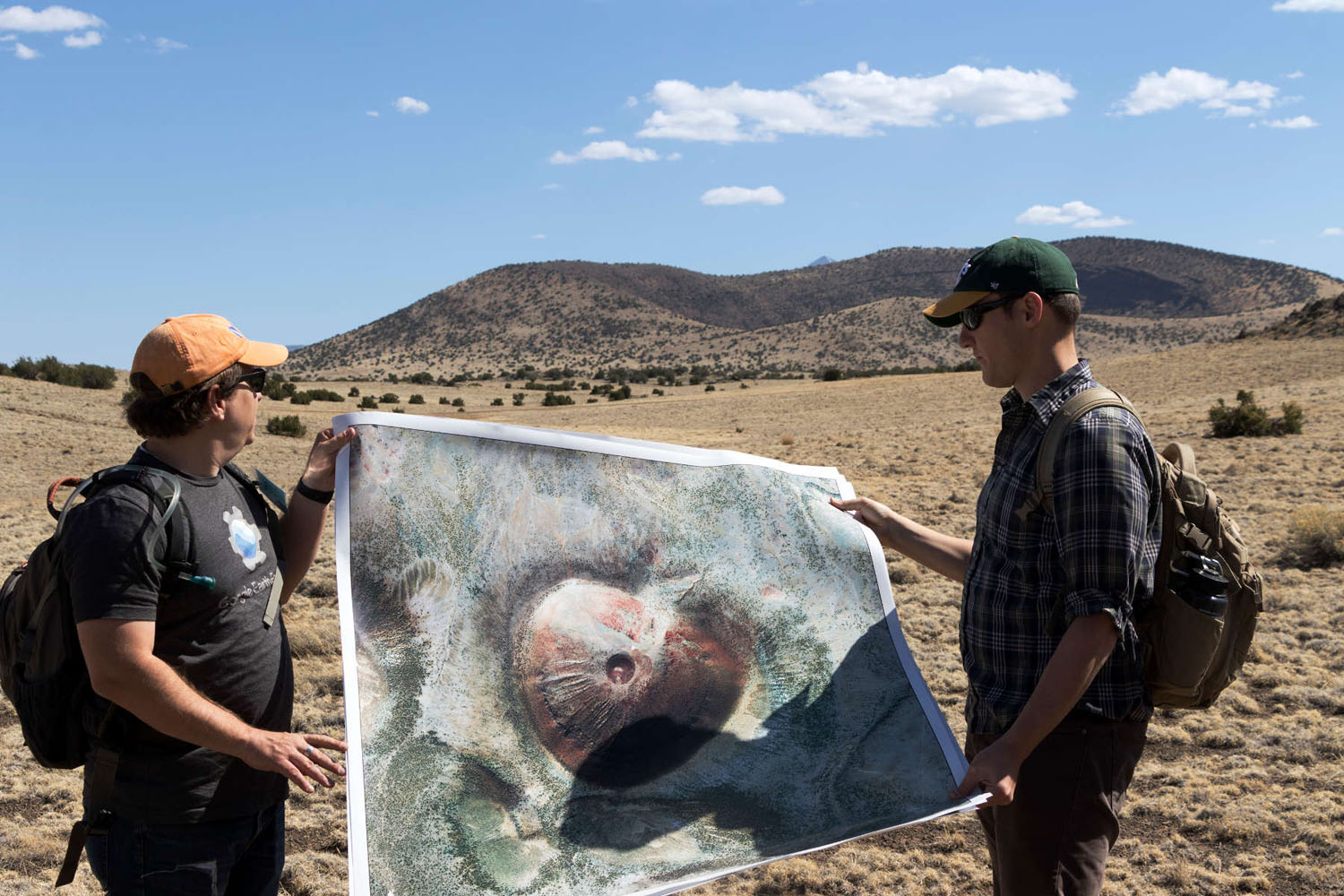
Chris and Mark with an aerial photo of Coulton Crater.
Coulton Crater has an very different shape from S P. This crater is ~2 km wide, with a height of 250 m, giving it a much slimmer aspect ratio of 0.125. In addition its central pit is nearly 1.2 km wide, giving it a vent ratio of 0.6 -- proportionately twice as large as S P's vent. Coulton's vent crater also lies 80 m (~260 feet) below the landscape outside the crater, much much deeper than most volcanoes in the San Francisco Volcanic field. The large crater exposes high cliffs containing a well defined sequence of scoria, cinders, and tuff, which tell us the sequence in which the volcano erupted material. Another interesting feature (not visible from where we stood, but forms the small red spot at the center of the aerial photo) is a small scoria cone (~6 m high and 30 m wide) located near the center of the crater. Although hard to see both from the ground and in aerial imagery, a small lava flow was erupted from Coulton Crater near the notch in its rim.
Holm and Ulrich (1987) pieced together the eruptive sequence at Coulton Crater. For most of its life, it appears to have followed the typical life cycle of a cinder cone volcano. Sometime between 200,000 and 700,000 years ago, the landscape ripped open along a fissure trending parallel to the Mesa Butte Fault. This fissure developed into a fire curtain eruption, which flooded the surrounding area with basaltic lavas. Eventually, the eruption became localized to one or two vents, which first built a spatter cone (a steep sided mound formed by splashing lava) that deposited the scoria found low on the central cliffs. As the spatter cone grew, material was only able to escape by more explosive eruptions, which blasted out the more gravelly cinders deposited on top of the scoria.
The magma feeding these eruptions was probably ascending from the mantle to the surface very quickly, since chunks of lava at Coulton Crater frequently contain small pieces of rock from the mantle and deep crust. These rocks usually melt and mix into the magma very quickly, so it would have needed to erupt very quickly to arrive at the surface intact. It is possible that the speed with which the magma was ascending led to the next phase of the volcano's evolution. At some point, magma began interacting with the regional aquifer, possibly as the magma began to pool underneath Coulton Crater. As water came into contact with hot rock, it flashed to steam, greatly increasing the explosive power of the eruptions. This type of groundwater-driven eruption is called a "phreatomagmatic" eruption. The explosions pulverized the rock, depositing the fine-grained tuff found at the top of the central cliffs. Interestingly, this tuff might preserve the prevailing wind direction during this phase of the eruption - the tuff is much thicker on the south rim of the crater, implying that wind was blowing from the north. At some point, one or more cataclysmic eruptions blasted out the large central crater. These explosions probably disrupted the supply of lava to the volcano, with the small amount of magma left under the volcano being erupted out to form the tiny cinder cone at the crater's center.
S P Crater was partially erupted onto an older cinder cone. The saddle formed between these two cones provides a spectacular view of the S P Lava Flow. Hiking up to the saddle, we took the chance to examine some of the materials blasted out of the crater during the eruption. The larger boulders, known as lava bombs, were partially molten as they were hurled out of the crater. Just imagine standing nearby as these came sailing through the air!
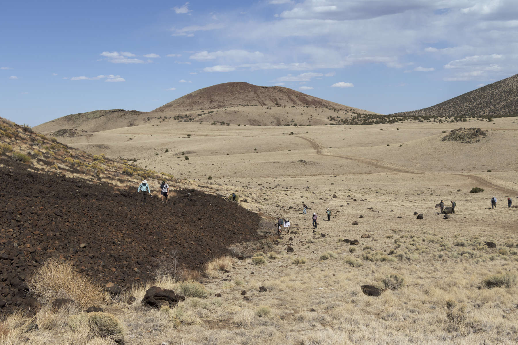
Unfortunately I did not think to get a picture of a bomb up close, but many of these had bands of bubbly material interspersed within otherwise solid rock. These layers, called flow bands, tell us that the lavas were actively outgassing and being mixed within the vent before they were blasted out. After a few minutes of looking at the bombs, we reached the saddle. As advertised, the view was incredible.
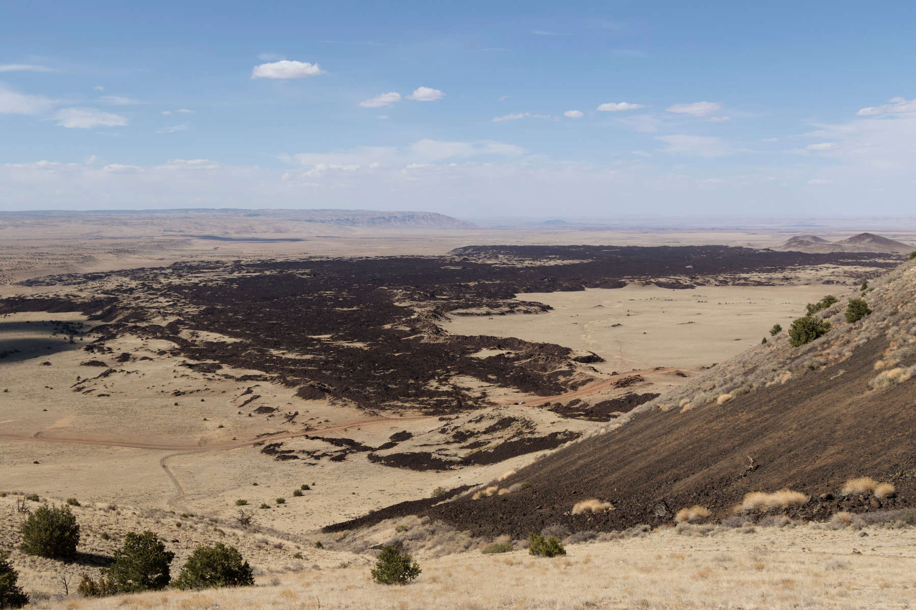
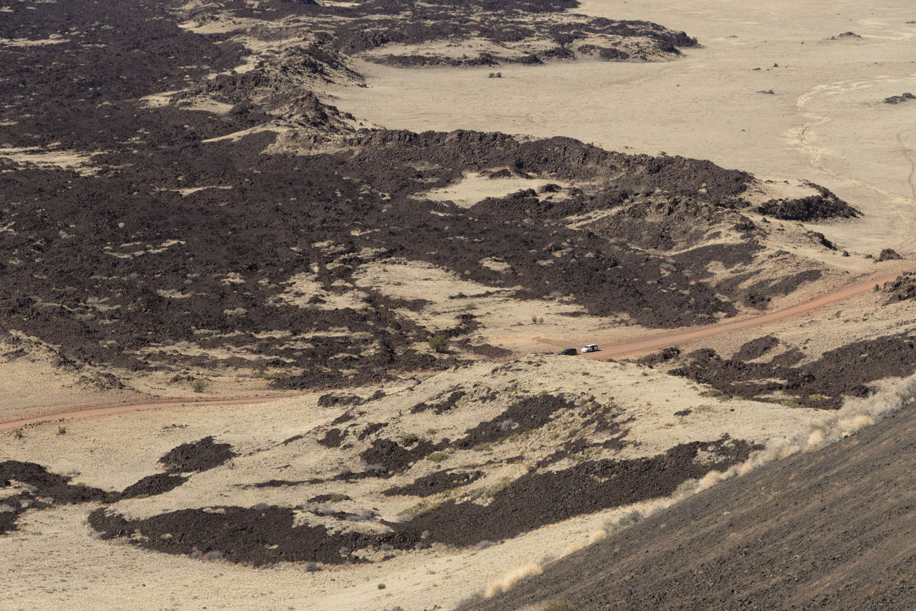
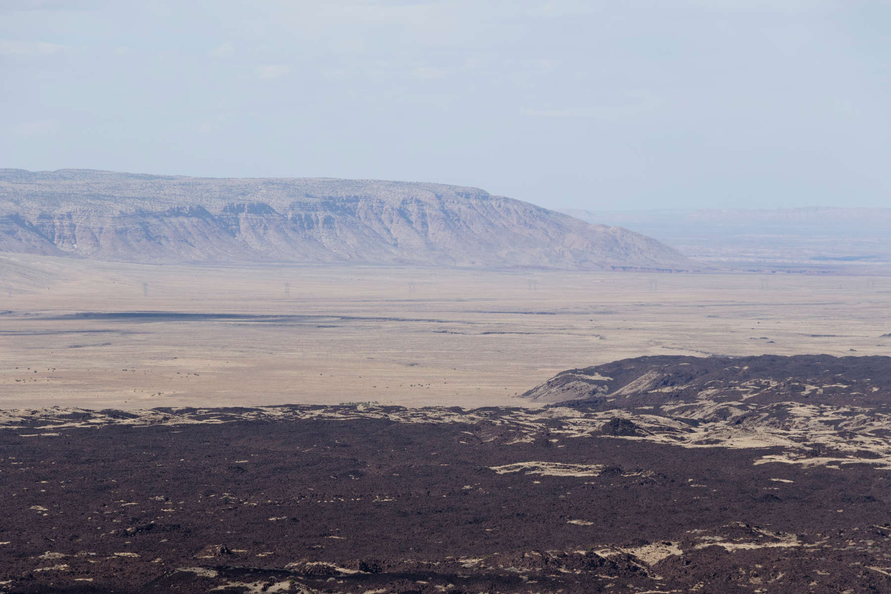
You can see a small escarpment along which a couple lobes of the lava flow have flooded up against. This escarpment defines a small normal fault that branches off of the Mesa Butte Fault to the north. This small fault was likely responsible for the location of the S P Crater eruption, as well as the neighboring cinder cone, Coulton Crater, and a couple other small cinder cones that align nearly perfectly with one another. We can also see that the flow had a bit of sidewinder motion. After flowing north away from the cone some distance, it switched directions and moved eastward before turning northward again. I suspect this is where the flow jumped from one fault valley to another, since this northward turn also lines up with another chain of cinder cones just to the east.
Another interesting feature visible from the saddle were the levees that helped channelize the lava flow. The levees are ridges of cooled and hardened lava that were pushed outwards by the weight of fluid lava trapped behind them. The force needed to push these ridges outwards effectively prevented the lava flow from expanding in any direction except the steepest slope downhill. The levees gradually get lower towards the end of the lava flow, eventually disappearing in the last few hundred meters. This suggests that the levees were originally about the height of the flow front. The lower surfaces within the levees is probably due to deflation of the flow surface once the underlying lava was able to drain downslope.
Finally, a look to the north shows how incredibly thick the S P Crater flow was at its end. Although the lava ramparts look small from a distance, they rise nearly 60 m (~200 feet) above the surrounding desert plains. Even further off in the distance, we can see the flat rocks lining the top of a distant plateau surface slowly twist downwards and disappear into the lowlands. These tilted rocks lie along the Mesa Butte Fault, the major extensional fault defining the western edge of the volcanic field. Looking at this rending of the landscape, we begin to get an appreciation of the forces fueling the activity in the San Francisco volcanic field.
As we descended from the saddle, we got a great view of Coulton Crater. The late afternoon lighting did a nice job of highlighting the layering within the crater. The tuffs deposited during the steam explosion phase form a soft looking surface along the rim. Underlying them are the finely layered layers deposited during the cinder cone-building phase, and the steep walls underneath these layers are the more solid lavas built by lava spatter during the initial phases of the eruption.
Like many of the geologic features in the Flagstaff area, the San Francisco Volcanic Field was a center of astronauts' geological education and field testing for equipment destined for the Moon during the Apollo era. This tradition continues today - NASA still brings astronauts to the area to learn and test out new concepts for crew vehicles that may one day end up on the Moon. SP and Coulton Craters are a frequent target for exploration by the Lunar Exploration Initiative, headed by David Kring at the Lunar and Planetary Institute in Houston.
Comparative studies between features like Coulton Crater and Meteor Crater have also helped geologists develop a sense of diagnostic landforms. Coulton Crater is often visited by impact scientists, since phreatomagmatic eruptions are remarkably good at creating landforms that look like impact craters. In fact, early geologists assessed several small impact craters as having formed through steam explosions! However, closer study has found a few points of difference between these craters. One is that impact craters typically show signs of shock metamorphism, while volcanic craters do not. Impact craters also tend to overturn pre-existing layers around the crater rim (as seen at Meteor Crater), while the rims of volcanic craters are usually littered with shattered rock and blobs of lava. The lower velocities of volcanic explosions also tend to allow much of the finer ash and debris emitted by the eruption to blow on the wind, creating asymmetrical patterns of fallout around the volcano. Impact craters (unless impacting at very shallow angles), tend to blast debris of all sizes in all directions. Larger impact craters can be distinguished by the presence of a central mound or peak, which forms as the target rocks rebound in response to an impact. These craters are called complex craters. The size at which complex craters form is dependent on a planet's gravity - larger planets form complex craters at smaller impact sizes. On Earth, complex craters form when an impact creates a crater larger than ~2 km, so if there is a crater of that size missing a central mound, it is most likely a volcanic structure.
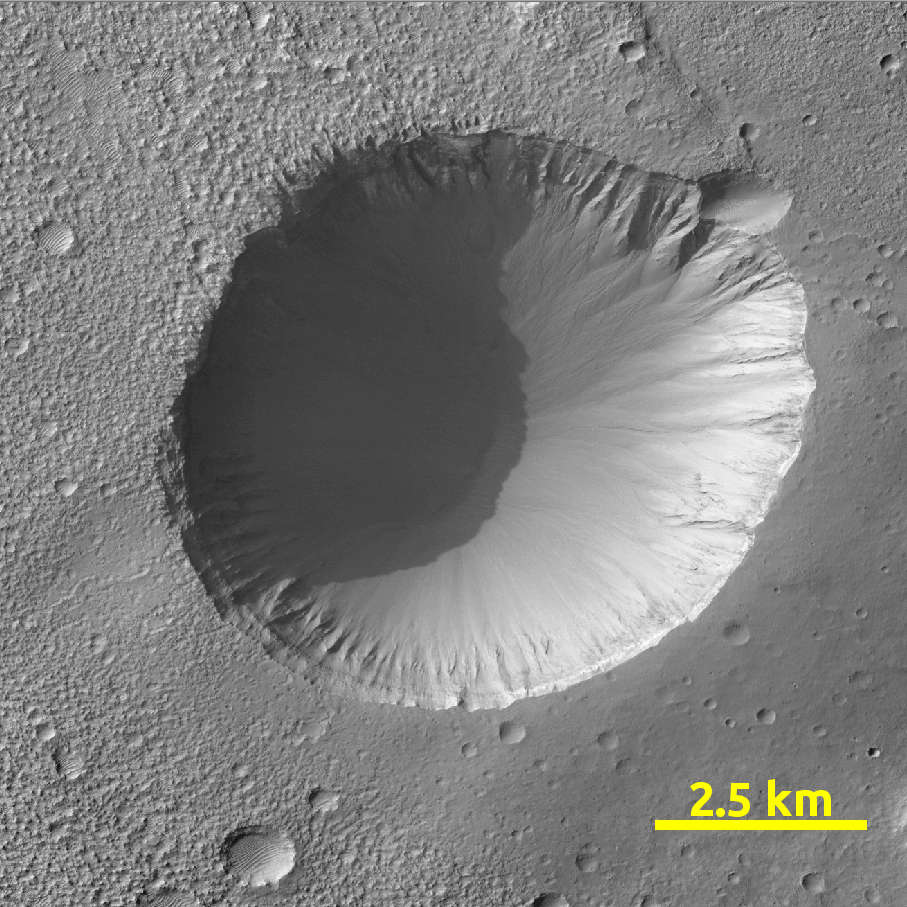
Despite the confusion they can cause, volcanic craters are useful tools in interpreting the geological history of a region. Large phreatomagmatic craters are helpful at identifying where groundwater or subsurface ice were once present, especially on arid planets like Mars. Here's an example of one such crater I found through one of my research projects, which I used to interpret some bedrock surfaces as having a possible volcanic origin.
And here is a similarly sized impact crater located roughly 30 km away:
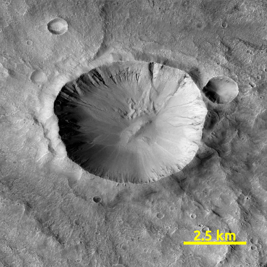
Can you see the differences? The primary difference between the two is that the phreatomagmatic crater has a more subdued rim. If you look carefully, you can also see that fine-grained material is preferentially distributed to the southeast, implying that the material blasted out of the crater was fine enough and moving slowly enough (probably no more than a few 10s of meters/s) that it could be carried by the wind. In the second crater, ejecta is evenly distributed in all directions. This is because the extremely high velocities involved in an impact flung material out of the crater at hundreds of meters per second. The impact crater also has a small mound at the middle -- Martian craters around this size typically have a central mound or peak.
Some larger Martian volcanoes are thought to be the result of phreatomagmatic eruptions. Here's Hadriacus Mons. This volcano has a very large central crater (which has been filled in by later lava flows), and the deep valley networks on its flanks are hallmarks of easily eroded materials.

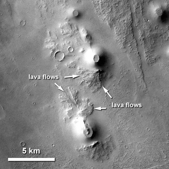
Cinder cones are also common on the Martian surface! Here are some cinder cones doing their best impression of S P Crater near Biblis Patera, a small volcano in the Tharsis region of Mars (from Broz et al. 2009)
Finding cinder cone fields can alert geologists to the presence of hot, fluid magma that is working its way up from a planet's mantle. Closer study of these fields and the structures associated with them can also provide a glimpse at the forces at work deep underneath a planet's surface, well out of reach of spacecraft observations.
After our discussion about planetary analogs, we called it a day and headed back to Flagstaff. Pretty sore from all the walking and climbing in and out of cars all day, I spent the evening nursing a beer and a pasty at the Cornish Pasty Co. in town. Reflecting on the trip, it was a whirlwind of fantastic geology. Getting to experience this geology up close gave me a better understanding of Martian landforms I had already spent two and a half years studying on a computer screen. Despite the ease of touring the entire Solar System from the comfort of an armchair, there's nothing quite like getting to see these landscapes in person.
Page Added: May 24, 2020